
Area 93.1 km² | Local time Thursday 4:45 AM | |
 | ||
Weather 25°C, Wind W at 5 km/h, 92% Humidity | ||
Paripueira is a municipality located in the Brazilian state of Alagoas. Its population is 8,762 (2005) and its area is 93 km².
Contents
Map of Paripueira, State of Alagoas, Brazil
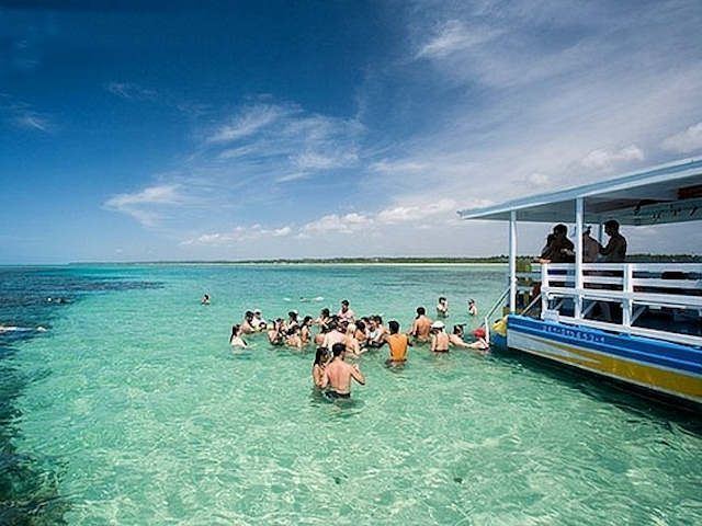
A tourist community, in the Tupi language “paripueira” means “calm waters”. Among the city's attractions are beautiful beaches with tide pools, such as the Praia de Sonho Verde (Green Dream Beach), which stands out for its beauty and for its infrastructure. In this ecological refuge can be found the Amazonian manatee, a threatened species unique to Latin America and protected here by the Municipal Marine Park for the Preservation of the Manatee.
Geography
Tourism
Paripueira is one of the longest beaches in Alagoas. At low tide it is possible to walk miles offshore in knee-deep water. The beach has summer homes, fishermen and 25 tide pools, the largest concentration of tide pools in the world. The coral formations in the region are considered the second largest barrier reef in the world.