
Country New Zealand Time zone NZST (UTC+12) Area code 03 | Territorial authority Postcode(s) 9793 | |
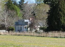 | ||
Parawa is a locality in Southland, New Zealand. It is situated on State Highway 6, 5 km south-west of Athol. It lies immediately north of the Mid Dome and its name is a corruption of Paiherewao, what Maori called the mountain. In the 19th Century several versions were used, including Parrawa and Parrowa.
Map of Parawa 9793, New Zealand
The Parawa Junction Hotel was built near where the main road crosses the Parawa Creek in 1867 to service the traffic travelling from the south coast to the Central Otago goldfields and to the nearby goldfield at Nokomai. This remained open for a century, then operated as a tearooms for a number of years before closing.
The Kingston branch railway opened through the district in January 1878, and soon after a siding was built. This operated until the closure of the line in November 1979. For many years Parawa was known for its very small post office which was open from 1904 until 1985.
Before the First World War a flaxmill, owned by I. W. Raymond & Co., was in operation near the entrance to the Nokomai Gorge. In 1904 it employed around 20 people.