
Surface elevation 58 m | Average depth 5 m (16 ft) Mean depth 5 m | |
 | ||
Catchment area 75×10^ m (75 km; 29 sq mi) Surface area 22.6×10^ m (22.6 km; 8.7 sq mi) Similar Gal Vihara, Polonnaruwa Vatadage, Minneriya National Park, Thuparamaya, Hatadage | ||
The huge lake parakrama samudra sri lanka sri lanka holidays
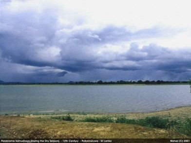
Parakrama Samudra (or King Parakrama's sea or the Sea of King Parakrama) is a shallow reservoir, consisting of three separate reservoirs connected by narrow channels in Polonnaruwa, Sri Lanka.
Contents
- The huge lake parakrama samudra sri lanka sri lanka holidays
- Map of Parakrama Samudra Sri Lanka
- Parakrama samudraya polonnaruwa lake sri lanka
- References
Map of Parakrama Samudra, Sri Lanka
The northernmost reservoir is the oldest and referred to as Topa wewa (Sinhalese wewa = lake or reservoir) built around 386. The middle section Eramudu wewa and the southernmost portion, at the highest elevation, is Dumbutula wewa, both sections were added and the reservoir expanded during the reign of King Parâkramabâhu I.
Parakrama samudraya polonnaruwa lake sri lanka
References
Parakrama Samudra Wikipedia(Text) CC BY-SA