
Local authority Northeast Hunters Corner, Otara South Puhinui North Middle | Population 39,585 (2001) Southeast Puhinui Local time Wednesday 9:28 PM | |
 | ||
Weather 20°C, Wind W at 18 km/h, 82% Humidity Train station Papatoetoe Railway Station | ||
Papatoetoe is a suburb in the Auckland conurbation in northern New Zealand. One of the larger suburbs of the area commonly known as South Auckland, it is located to the northwest of central Manukau, and 18 kilometres southeast of Auckland city centre.
Contents
- Map of Papatoetoe Auckland New Zealand
- History
- Town centre
- Papatoetoe Historical Society
- Rugby union
- Rugby league
- Association football
- Cricket
- Tennis
- Primary education
- Secondary education
- Mayors
- Notable people
- Attractions
- References
Map of Papatoetoe, Auckland, New Zealand
Papatoetoe is a Māori name, which can be loosely translated as 'undulating area where the toetoe is the predominant feature', making it named after the 'Prince of Wales' feather (or toetoe / toi toi), which grew abundantly in the swampy parts of the region. Due to some confusion over the spelling, the area was known as Papatoitoi for many years.
History
People have lived in the Papatoetoe area for almost the entire time of human settlement in New Zealand. For both the original Māori and the first English settlers, the Papatoetoe area was handily located close to the narrowest points between Auckland's two great harbours, where waka could be ported over land. It was also rich in fertile soil.
Inlets run from Papatoetoe eastward to the Waitemata Harbour and westward to the Manukau Harbour. Thus for travellers past and present the routes south to the Waikato River and the north to the Auckland isthmus - Tamaki-makau-rau (Tamaki coveted by many) - have always been through Papatoetoe.
The definition of the Papatoetoe Highway district in 1865 and the Papatoetoe Town Board in 1919 helped establish the town. The first council Papatoetoe Borough Council was created in 1946 followed by the Papatoetoe City Council in 1965. The Papatoetoe City Council was merged into the Manukau City Council in 1989. Papatoetoe is now a suburb in the Manukau Ward which is part of the Auckland Council.
The area's main population growth occurred after World War II, when many returning service men received housing in the area. By 1980, population growth had mostly ceased, with all available land taken up, though some infill housing growth occurred later. The population in 2006 had a median age of 31, with 34% being NZ Europeans, 33% Asians, 26% Pacific Islanders and 16% Maori.
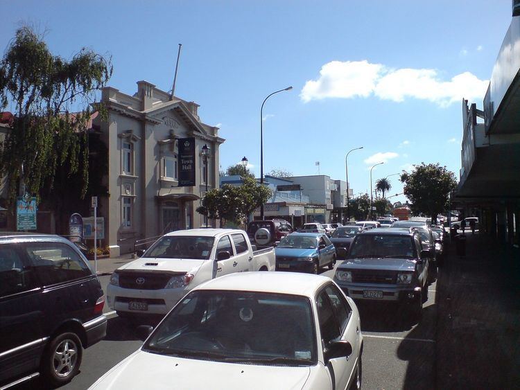
Town centre
Manukau City Council has in early 2009 announced plans to spend millions revitalising the town's centre in the St. George Street area. New apartment buildings and nearby sports facilities (centred on a NZ$12 million multisports centre) are to encourage new shops to the area, which has deteriorated in the past, partly due to competition from shopping malls.
Papatoetoe Historical Society
Papatoetoe Historical Society was established in 1988 with the aim to gather the historical artifacts and information from the Papatoetoe district. The collection held includes a collation of information on Local Body members, schools as they developed, the origin and meaning of street names, women of the district (book available), people of the surrounding farming district, newspaper cuttings and information on local organisations. The society has also developed an archive collection which includes photographs, books, booklets, plans and posters. These collections can be viewed at the Papatoetoe Historical Society museum which is housed in the old Papatoetoe Council works depot at 91 Cambridge Terrace, Papatoetoe.
In 2012 Papatoetoe celebrated 150 years of civic life. The Papatoetoe 150 was initiated by the Papatoetoe Historical society to increase awareness of history and promote community organisations.
Rugby union
Papatoetoe Rugby Football Club was established in 1946 and plays home matches at the Papatoetoe Sport Complex on Great South Road.
Rugby league
Papatoetoe is home to the Papatoetoe Panthers who are affiliated with the Auckland Rugby League.
Association football
Papatoetoe is home to Papatoetoe AFC who compete in the Lotto Sport Italia NRFL Division 1A. Papatoetoe is home to Papatoetoe United who play from the sports complex on Great South Road and are affiliated with Auckland Football Federation.
Cricket
Papatoetoe is home to the Papatoetoe Cricket Club who play in the Auckland Cricket Championship.
Tennis
Papatoetoe is home to two tennis clubs, Papatoetoe Tennis Club located at Papatoetoe Sports Complex and Sunnyside Tennis Club located in the Sunnyside Domain. Both clubs are affiliated to Auckland Tennis. Sunnyside Tennis Club was formed originally as Puhunui Tennis Club in 1955.
Primary education
Papatoetoe has eight primary schools in its zone:
Papatoetoe has two intermediate schools:
Secondary education
Papatoetoe has two secondary schools: