
Country Pakistan Tehsil Swabi Province Khyber Pakhtunkhwa | District Swabi Population 13,936 (1998) | |
 | ||
Panjpir swabi
Panjpir, Pakistan, is a town and union council in district Swabi that is surrounded by Shahmansoor, Kaddi, Thand Kohi, Bam Khel, Dara and Ismailabad.
Contents
Map of Panjpir, Pakistan
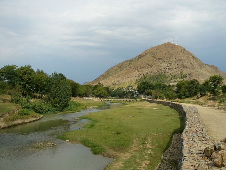
It is located approximately 100 Kilometers both from Peshawar and Islamabad through recently constructed Peshawar Islamabad Motorway (M-I) with nearest approach at Swabi Interchange near Ambar village on the right bank of Indus River.Panj Pir Ghar (Panj Pir Mountain) with its sharpest ridge rises to the height of 2,130 feet above sea level or 940 feet above the Yousafzai plain, (Source Gazetteer of Peshawar District 1897-98) while highest peak of the Panj Pir hills is at 2,053 feet altitude from the sea level according to a recent Topo-Sheet issued by the Survey of Pakistan.
The area is bounded by the mountain Panjpir Ghar to its north, Badrai Khwar to its west, the Pehur Lift Canal to its east.
Total population of the village was 1,065 - Muslims were 1,054 with 542 males & 512 females while Hindus were 11 with 8 males and 3 female total 1,065 persons in 1869. (Source: Tareekh-e-Peshawar). Total population of the village was 3,175 in 1951, 8,227 in 1981 and 13,936 (Males 6,854 and Females 7,082) according to Census of 1998 conducted by the Government of Pakistan. Literacy rate in the same year was 49.30% of the total population.
Total area of Panj Pir is 3,205 Acres or 25,640 Kanals including streams, mountain, hillocks, ravines and a large cemetery.