
Local time Tuesday 6:57 PM | ||
 | ||
Weather 26°C, Wind E at 16 km/h, 66% Humidity | ||
Pancas is a Brazilian municipality in the state of Espírito Santo. Its population was 20,025 (2005) and its area is 824 km².
Contents
Map of Pancas, State of Esp%C3%ADrito Santo, Brazil
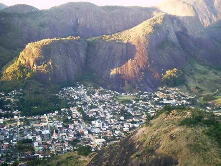
It is situated on a tributary of the Doce River, in the northwest of the state. Locally it is known as a good spot for paragliding. The landscape around the town is distinguished by large numbers of granite inselbergs, and Pedra Agulha ("Needle Rock") near the town is the second highest "chaminé" (high, vertical-sided granite rock) in Brazil - the highest being the famous Corcovado in Rio de Janeiro.
History
Before the European colonizers arrived, the area was inhabited by Amerindians. The first European settlers founded a village called São Silvano, but that was destroyed by the local Amerindians. The first permanent residents arrived in 1918 looking for valuable minerals, but the region of the Doce River was practically uninhabited till 1925, it was then that the first bridge over the Doce River was built, called Florian Avidos Bridge, and this brought more people into the north of the state for the first time. The bridge primarily opened access to logging companies which brought more people and coffee plantations, opening their way to the valley where Pancas is situated. The first settlement in the area was founded in 1925, and was called Nossa Senhora Da Penha.
Immigrants to the town in the 1920s and 1930 included large numbers of ethnic Germans, and the German dialect Pomeranian (now almost extinct in Europe) is still spoken in the area.