
Country Peru Established 21 June 1825 Elevation 3,276 m Local time Tuesday 1:17 PM Area code 067 | Region Huancavelica Time zone PET (UTC-5) Area 52.26 km² Province Tayacaja Province | |
 | ||
Website www.munitayacaja.gob.pe Weather 15°C, Wind NE at 19 km/h, 58% Humidity | ||
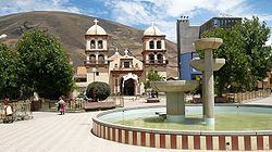
Pampas is a city in Peru. It is the capital of the Tayacaja Province and it was established on June 21, 1825. According to the 2007 census had a population of 9,973 (11,566 in the metropolitan area). It has an approximate altitude of 3,276 metres.
Contents
Map of Pampas, Peru
Transportation
The city is connected to the nearby cities like Huancayo and Ayacucho by partially paved roads.
Education
The city house a branch of the Universidad Nacional de Huancavelica and it is home of a local technical institute; the Instituto Tecnologico Pampas - Tayacaja.
Health
The city has now a new hospital, the Hospital Pampas that serve the city and the towns nearby.
References
Pampas, Peru Wikipedia(Text) CC BY-SA