
- elevation 541 ft (165 m) - min 0 cu ft/s (0.0 m/s) Basin area 8,555 km² Basin area 8,555 km² | - average 599 cu ft/s (17.0 m/s) Length 269 km Discharge 16.96 m³/s | |
 | ||
- max 27,800 cu ft/s (787.2 m/s) | ||
The Palouse River is a tributary of the Snake River located in the U.S. states of Washington and Idaho. It flows for 167 miles (269 km) southwestwards, primarily through the Palouse region of southeastern Washington. It is part of the Columbia River Basin, as the Snake River is a tributary of the Columbia River.
Contents
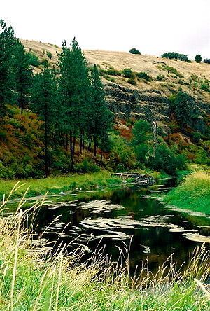
Map of Palouse River, Washington, USA
Its canyon was carved out by a fork in the catastrophic Missoula Floods of the previous ice age, which spilled over the northern Columbia Plateau and flowed into the Snake River, eroding the river's present course in a few thousand years.
CourseEdit
The Palouse River flows from northern Idaho into southeast Washington through the Palouse region, named for the river.
The river flows through northern Latah County near State Highway 6 as it nears the state line. In Washington, the river flows in Whitman County to Palouse and then to Colfax, where it meets with the south fork, from Pullman and south of Moscow. From Colfax the river meanders west and ends up in the lower Snake River southwest of Hooper, but not before dropping over Palouse Falls. The Palouse River enters the Snake River below the Little Goose Dam and above the Lower Monumental Dam.
Basin and dischargeEdit
The Palouse River's drainage basin is 3,303 square miles (8,550 km2) in area. Its mean annual discharge, as measured by USGS gage 13351000 at Hooper (river mile 19.6), is 599 cubic feet per second (17 m3/s), with a maximum daily recorded flow of 27,800 cu ft/s (787 m3/s), and a minimum of zero flow.
GeologyEdit
The Missoula Floods that swept periodically across eastern Washington and across the Columbia River Plateau during the Pleistocene epoch carved out the Palouse River Canyon, which is 1,000 feet (300 m) deep in places.
The ancestral Palouse River flowed through the now-dry Washtucna Coulee directly into the Columbia River. The present-day canyon was created when the Missoula Floods overtopped the northern drainage divide of the ancestral Palouse River, diverting it to the current course to the Snake River by eroding a new, deeper channel.
The area is characterized by interconnected and hanging flood-created coulees, cataracts, plunge pools, kolk created potholes, rock benches, buttes and pinnacles typical of scablands.