
Area 24.12 km² | ||
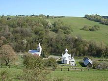 | ||
Palota is a village and municipality in the Medzilaborce District in the Prešov Region of far north-eastern Slovakia.
Contents
Map of 068 01 Palota, Slovakia
History
In historical records the village was first mentioned in 1330.
Geography
The municipality lies at an altitude of 482 metres (1,581 feet) and covers an area of 24.116 square kilometres (9.311 square miles). It has a population of about 190 people.
References
Palota Wikipedia(Text) CC BY-SA