
Country United States GNIS feature ID 453704 Local time Tuesday 10:52 AM | FIPS code 18-57744 Elevation 154 m Population 1,466 (2010) | |
 | ||
Weather 11°C, Wind NE at 19 km/h, 79% Humidity Area 97.07 km² (97.05 km² Land / 3 ha Water) | ||
Palmyra Township is one of ten townships in Knox County, Indiana. As of the 2010 census, its population was 1,466 and it contained 612 housing units.
Contents
Map of Palmyra Township, IN, USA
History
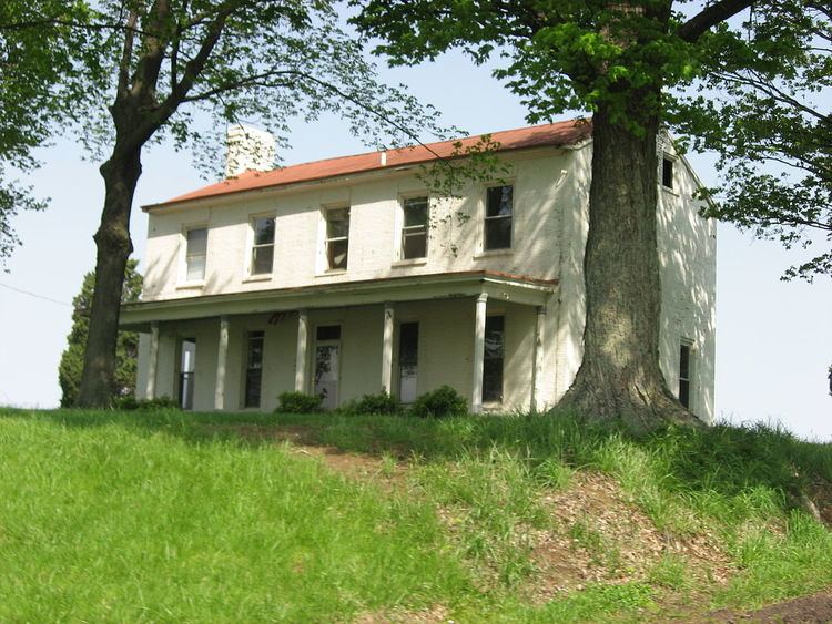
Shadowwood was added to the National Register of Historic Places in 2001. Rose Hill Farmstead was formerly listed.
Geography
According to the 2010 census, the township has a total area of 37.48 square miles (97.1 km2), of which 37.47 square miles (97.0 km2) (or 99.97%) is land and 0.01 square miles (0.026 km2) (or 0.03%) is water.
References
Palmyra Township, Knox County, Indiana Wikipedia(Text) CC BY-SA