
Founded June 6, 1790 Population 37,954 (2013) Unemployment rate 4.1% (Apr 2015) | Website www.knoxcounty.in.gov | |
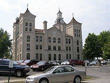 | ||
Colleges and Universities Vincennes University, Vincennes Beauty College Points of interest George Rogers Clark Nati, Grouseland, Buffalo Trace Park, Indiana Military Museum, Harrison Mansion | ||
Knox County is a county located in Indiana in the United States. It was one of two original counties created in the old Northwest Territory in 1790 and was reduced to its present size in 1817. As of 2010, the population was 38,440. The county seat is Vincennes.
Contents
- Map of Knox County IN USA
- History
- Geography
- Major highways
- National protected area
- Cities
- Towns
- Census designated places
- Townships
- Climate and weather
- Government
- Demographics
- Workforce
- References
Map of Knox County, IN, USA
History
In 1790, Winthrop Sargent, Secretary of Northwest Territory, organized the first Indiana county, Knox County. It was named for Major General Henry Knox, U.S. Secretary of War.
Knox County was one of the original counties of the Northwest Territory and was created prior to the formation of the Indiana Territory. When it was created, Knox County extended to Canada and encompassed all or part of the present states of Indiana, Michigan, Illinois, and Ohio. When the Illinois Territory was formed in 1809, the portions of Knox County beyond the Wabash River became a part of Illinois.
Many of Knox Country townships and lots were surveyed with the French system, which goes towards non-cardinal compass points. Knox and Clark counties are the only ones laid out in this fashion.
Geography
According to the 2010 census, the county has a total area of 524.04 square miles (1,357.3 km2), of which 516.03 square miles (1,336.5 km2) (or 98.47%) is land and 8.01 square miles (20.7 km2) (or 1.53%) is water.
Major highways
National protected area
Cities
Towns
Census-designated places
Townships
Climate and weather
In recent years, average temperatures in Vincennes have ranged from a low of 18 °F (−8 °C) in January to a high of 88 °F (31 °C) in July, although a record low of −26 °F (−32 °C) was recorded in January 1994 and a record high of 104 °F (40 °C) was recorded in June 1988. Average monthly precipitation ranged from 2.51 inches (64 mm) in February to 5.13 inches (130 mm) in May.
Government
The county government is a constitutional body, and is granted specific powers by the Constitution of Indiana, and by the Indiana Code.
County Council: The county council is the legislative branch of the county government and controls all the spending and revenue collection in the county. Representatives are elected from county districts. The council members serve four-year terms. They are responsible for setting salaries, the annual budget, and special spending. The council also has limited authority to impose local taxes, in the form of an income and property tax that is subject to state level approval, excise taxes, and service taxes.
Board of Commissioners: The executive body of the county is made of a board of commissioners. The commissioners are elected county-wide, in staggered terms, and each serves a four-year term. One of the commissioners, typically the most senior, serves as president. The commissioners are charged with executing the acts legislated by the council, collecting revenue, and managing the day-to-day functions of the county government.
Court: The county maintains a small claims court that can handle some civil cases. The judge on the court is elected to a term of four years and must be a member of the Indiana Bar Association. The judge is assisted by a constable who is also elected to a four-year term. In some cases, court decisions can be appealed to the state level circuit court.
County Officials: The county has several other elected offices, including sheriff, coroner, auditor, treasurer, recorder, surveyor, and circuit court clerk Each of these elected officers serves a term of four years and oversees a different part of county government. Members elected to county government positions are required to declare party affiliations and to be residents of the county.
Knox County is part of Indiana's 8th congressional district; Indiana Senate districts 39 and 48; and Indiana House of Representatives districts 45 and 64.
Demographics
As of the 2010 United States Census, there were 38,440 people, 15,249 households, and 9,725 families residing in the county. The population density was 74.5 inhabitants per square mile (28.8/km2). There were 17,038 housing units at an average density of 33.0 per square mile (12.7/km2). The racial makeup of the county was 94.9% white, 2.6% black or African American, 0.6% Asian, 0.2% American Indian, 0.5% from other races, and 1.2% from two or more races. Those of Hispanic or Latino origin made up 1.5% of the population. In terms of ancestry, 26.9% were German, 19.9% were American, 13.0% were Irish, and 9.1% were English.
Of the 15,249 households, 29.1% had children under the age of 18 living with them, 48.5% were married couples living together, 11.1% had a female householder with no husband present, 36.2% were non-families, and 30.1% of all households were made up of individuals. The average household size was 2.35 and the average family size was 2.90. The median age was 38.5 years.
The median income for a household in the county was $47,697 and the median income for a family was $51,534. Males had a median income of $40,553 versus $27,201 for females. The per capita income for the county was $20,381. About 12.6% of families and 16.4% of the population were below the poverty line, including 22.7% of those under age 18 and 11.4% of those age 65 or over.
Workforce
In 2005, Knox County had 998 business units and 16,240 jobs. The largest employing industry in the county was education and health services (including both public and private employment) with almost 34 percent of total industry employment. Trade, transportation, and utilities came in second with over 22 percent of total industry employment. Manufacturing showed the most job growth and the largest percentage gain since 2001, increasing 316 jobs or almost 21 percent.
The 2005 all industry earnings average for Knox County was $26,875, up $2,824 or 11.7 percent over the county’s 2001 average. The manufacturing industry had the highest average annual earnings at $33,238, increasing $1,695 since 2001. Annual earnings in the information sector increased the most between 2001 and 2005, up $6,518 or 29.7 percent.
The Vincennes area has a diversified economy. In 2005 retail trade was the largest of 20 major sectors. It had an average wage per job of $19,743. Per capita income grew by 17.9% between 1994 and 2004 (adjusted for inflation). While manufacturing accounts for 8.2% of the jobs, the services sector is rapidly growing. Knox County's ground breaking Pathways Program insures a well-trained, highly motivated labor force. Knox County encompasses an area that attracts approximately 300,000 potential employees within an easy commute. Because of the proximity of the surrounding counties, and ease of access to the Vincennes area, businesses routinely draw from a labor force that lies within a 50-mile radius of their work site.