
Type Highway Major settlements Palmerston | Route number(s) State Route 25 Length 75 km | |
 | ||
East end Bruce Highway, Innisfail, Queensland | ||
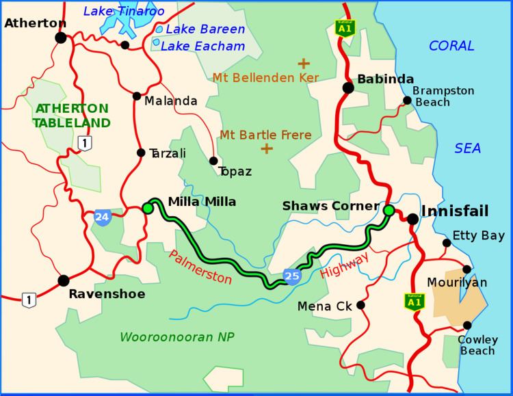
The Palmerston Highway (State Route 25), serves as a link between the southern part of the Atherton Tablelands and the Far North Queensland coastal strip, in Australia. Starting just north of Innisfail, from the Bruce Highway it winds through the Wooroonooran National Park to the township of Millaa Millaa, where it terminates. Its total length is 54.6 kilometres. From here State Route 25 continues west and then north as Millaa Millaa-Malanda Road, while Old Palmerston Highway continues south and then west as a Tourist Drive (not suitable for caravans) to where it meets the Kennedy Highway north of Ravenshoe.
Map of Palmerston Hwy, Queensland, Australia
References
Palmerston Highway Wikipedia(Text) CC BY-SA