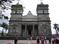
Area 38.06 km² | Founded 30 July 1888 Population 37,471 (Jun 2013) | |
 | ||
Palmares is the seventh canton in the Province of Alajuela in Costa Rica.
Contents
Map of Alajuela Province, Palmares, Costa Rica
Geography
The canton covers an area of 38.06 million km², and has a population of 37,471.
The capital city of the canton is also called Palmares.
Geography
The canton encompasses a circular area with the city of Palmares at its center. The Montes de Aguacate (Avocado Mountains) establish the boundary on the canton's southwestern edge and the Río Grande (Great River) delineates the boundary on its north and northeast sides.
Districts
The Canton of Palmares is subdivided into seven districts (distritos):
- Palmares
- Zaragoza
- Buenos Aires
- Santiago
- Candelaria
- Esquipulas
- La Granja (Granja)
History
The first settlers in what today is Palmares are believed to have arrived in 1835 from the cities of Alajuela and Belen, looking for land where to cultivate tobacco and other products.
References
Palmares (canton) Wikipedia(Text) CC BY-SA
