
Country Bangladesh District Dhaka District Area 17 km² | Division Dhaka Division Time zone BST (UTC+6) | |
 | ||
Website bangladesh.gov.bd/maps/images/dhaka/PallabiT.gif | ||
Pallabi (Bengali: পল্লবি) is a Thana of Dhaka District in the Division of Dhaka, Bangladesh.
Contents
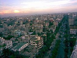
Map of Pallabi, Dhaka, Bangladesh
Geography
Pallabi is located at 23.495°N 90.215°E / 23.495; 90.215. Its total area is 17 km².
Demographics
This Pallabi has a population of 364000. Males constitute 52.74% of the population, and females 47.26%. Pallabi has an average literacy rate of 56.23%, and the national average of 32.4% literate.
Administration
Pallabi has 1 Unions/Wards, 16+27 Mauzas/Mahallas, and 0 villages.
References
Pallabi Thana Wikipedia(Text) CC BY-SA