
Hangul 팔공산 Revised Romanization Palgongsan Elevation 1,193 m Parent range Taebaek Mountains | Hanja 八公山 McCune–Reischauer P'algongsan Province North Gyeongsang Province | |
 | ||
Similar Biseulsan, Gayasan, Geumosan, Geumjeongsan, Songnisan | ||
Trip to palgongsan
Palgongsan, also Palgong Mountain, is a mountain in southeastern South Korea, lying on an outlier of the Taebaek range. It stands on the northeastern border between Daegu metropolitan city and North Gyeongsang province (including the districts of Chilgok County, Gunwi County, Yeongcheon, and Gyeongsan). Its peak is 1193 m above sea level.
Contents
- Trip to palgongsan
- Map of Palgongsan Bugye myeon Gunwi gun
- Exploring palgongsan daegu south korea
- References
Map of Palgongsan, Bugye-myeon, Gunwi-gun
The mountain is the site of a number of cultural and natural heritage sites. These include Buddhist shrines from the Silla period or later, including the large and active temple of Donghwasa and the Gunwi Triad Budda Grotto (National Treasure 109). In addition, in 927 the Battle of Gong Mountain was fought between Hubaekje and Goryeo forces on the mountain's southern slope.
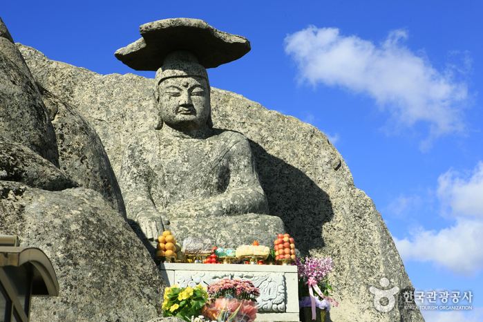
Natural treasures include the standing stone of Gatbawi, so called from its resemblance to a traditional Korean horsehair hat, or gat.
The mountain, connected to downtown Daegu by bus, is a popular site for weekend outings from the city. Portions of the mountain were designated a provincial park in 1980.