
Max. depth 12 m (39 ft) Shore length 140 km (87 mi) Area 400 km² | Surface area 400 km (150 sq mi) Salinity 5.5 ppm Settlements Parnu Settlement Pärnu | |
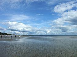 | ||
Pärnu Bay (Estonian: Pärnu laht) is a bay in the northeastern part of the Gulf of Livonia (Gulf of Riga), in southern Estonia.
Contents
Map of P%C3%A4rnu Bay, Estonia
Geography
It has an area of 411 km². The maximum depth in the mouth of the bay is 12 m. The banks are low-lying, sandy in some places. The salinity of the water in the bay is 0-0,8 ppm in the spring and up to 5.5 ppm in autumn.
There are several rivers flowing into the gulf, the largest is a River Pärnu.
The bay is also Estonia's most important coastal fishing area.
References
Pärnu Bay Wikipedia(Text) CC BY-SA