
Rank Village Area 22.21 km² Postal code 2214 KSH code 22248 | Subregion Nagykátai Time zone CET (UTC+1) Population 2,083 (1 Jan 2008) Area code 29 | |
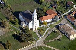 | ||
Pánd is a village in Pest county, Hungary.
Contents
Map of P%C3%A1nd, Hungary
Location
Pánd is located between the towns of Káva and Tápióbicske along the minor road connecting Nagykáta and Monor. It is almost entirely located in the valleys of Őr Hill and Dobos Hill. A smaller stream crosses the southern part of the settlement that empties into the river Tápió which is part of the Danube's drainage basin.
References
Pánd Wikipedia(Text) CC BY-SA