
Length 44 km | Basin size 278 km (107 sq mi) | |
 | ||
Main source near Béthonvilliers222 m (728 ft) Tributaries Left:MontparentièreRight:Sainte Suzanne, Esse, Tronchet, Vollards | ||
Agomon unreleased track ozanne
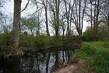
The Ozanne is a 44 km long French river, a tributary of the Loir, a tributary of the Loire.
Contents
- Agomon unreleased track ozanne
- Map of LOzanne France
- Leading evangelical jayne ozanne comes out as gay
- GeographyEdit
- TributariesEdit
- WatershedEdit
- HydrologyEdit
- Low watersEdit
- FloodsEdit
- Water slide and debitEdit
- Mill localitiesEdit
- ZNIEFFEdit
- References
Map of L'Ozanne, France
Leading evangelical jayne ozanne comes out as gay
GeographyEdit
The river spring is located at Perche-Gouët, Béthonvilliers at 222 m high at le Burail locality in le Bois de Beaumont.
2 offshoots: la Suzanne ou Sainte-Suzanne et l'Ozanne de Dampierre ou Moranne ou Mozanne which join near Brou.
It flows into le Loir, right bank, 1 km north of Bonneval at 129 m high at Ouzenain (locality).
TributariesEdit
The Ozanne has 7 official affluents (14 including sub-affluents) :
Strahler number of 3
WatershedEdit
The hydrological area of the Ozanne and its affluents is 278 km² wide, which is composed of farming land (91.52%), of forests and semi-natural areas (6.55%), artificial areas (1.76%) and damp areas (0.12%).
HydrologyEdit
The Ozanne debit was studied from 1973 to 2014 at Prémoteux, near Trizay-lès-Bonneval at 126 m high, very close to its meeting point with the Loir. The river watershed is of 268 km² (96% of the 278 km²).
The river module at Trizay-lès-Bonneval is of 1.46 m³/s.
The river presents impotent seasonal debital fluctuations, with high waters in Winter: mean monthly debit of 2,71 and 3.61 m³/s, from December to March (peak in January) and low waters in Summer, end of May to beginning of October, with a mean monthly debit drop of up to 0.235 m³ in August (235 L/s).
Low watersEdit
However, the 3-day low-water volume can drop to a severe 0.044 m³ during a dry five-year period (or 44 L/s).
FloodsEdit
Floods can also be important.
The maximal debit recorded was 65.2 m³/s on January 22, 1995, while the maximal daily worth was of 52.6 m³/s on April 10, 1983, which is expected to happen every 10 to 15 years on average. The maximal height was of 1920 mm (or 1.92 m) on January 14, 2004.
Water slide and debitEdit
The yearly precipitation in the Ozanne basin is of a modest 173 mm, far below the national average, but also to that of la Loire (244 mm yearly), closer to its neighboring river Yerre (176 mm), with an average debit of 5.5 L/s and km².
Mill localitiesEdit
Géoportail records 11 "mill" localities : le moulin de Vinet, le moulin de l'Orme, le moulin Foulon, le moulin Vieux et un gué, le moulin Brière, le moulin de Forçonnerie, le moulin d'Epasses, le moulin de Georges, le moulin de la Varenne, le moulin de Patry, un gué, le moulin de Frécot.
ZNIEFFEdit
The river Ozanne marks the northern limit of a little ZNIEFF Chenaie-charmaie de la Poupelière.