
 | ||
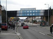
Oxford Road is a major arterial road in Reading, Berkshire, England, near the town centre. The road leads west to Pangbourne, continuing eventually to the city of Oxford. The road was previously known as Pangbourne Lane.
Contents
Map of Oxford Rd
Most of the road is designated the A329. Reading West railway station is near the eastern end of Oxford Road. Tilehurst railway station is near the western end of the road, serving the Reading suburb of Tilehurst. The road to the northwest becomes Purley Rise at Purley on Thames, leading to Pangbourne. To the east in central Reading, it becomes Broad Street, the main pedestrianised shopping street in Reading.
Oxford Road Community School is located at 146 Oxford Road. Battle Library is at 420 Oxford Road. The Oxford Road Community Garden is located in Western Elms Avenue, off the Oxford Road.
The Chatham Street development off Oxford Road, which is still under construction (as of 2010), offers possible improvement for this part of Reading with a £250 million investment scheme, including new shops, accommodation, services and leisure facilities.
Notable Residents
Mike Oldfield's Family lived on Western Elm Avenue, where his Father worked as a General Practitioner.
Trivia
The first Little Chef Restaurant was opened on Oxford Road in 1958.