
Country United States County Bath Named for a local landowner Elevation 306 m Local time Tuesday 3:30 PM Area code 606 | Incorporated c. 1811 Time zone Eastern (EST) (UTC-5) Zip code 40360 Population 1,562 (2013) | |
 | ||
Weather 17°C, Wind NW at 10 km/h, 78% Humidity Area 6.242 km² (6.19 km² Land / 5 ha Water) | ||
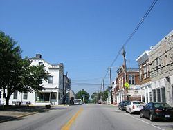
Owingsville is a home rule-class city in Bath County, Kentucky, in the United States. The population was 1,530 during the year 2010 U.S. Census. It is the county seat and is located roughly at the county's center, at the junction of US 60 and Kentucky 36. It is part of the Mount Sterling micropolitan area.
Contents
Map of Owingsville, KY 40360, USA
History
In 1795, Colonel Thomas Dye Owings was sent from Maryland to Kentucky by his father to operate some of the first iron furnaces in the region. Within fifteen years, Owings had amassed a good deal of wealth and land. Along with Colonel Richard H. Menefee, Owings would found the community that took his name, Owingsville.
Owings and Menefee each owned significant parcels of land in what would become Owingsville. To select whose name the community would take, the two men wagered that the man who built the finer home the quickest would be the namesake of the town. For the sum of $60,000, Owings won the contest. Owingsville was then founded in 1811.
Owingsville was the birthplace of Civil War general John Bell Hood, Indiana governors Henry S. Lane and Claude Matthews, and Tennessee governor Alvin Hawkins.
Every year the county celebrates with the May Day Pageant, where high school seniors can compete for the title of "Miss Bath County". The pageant tradition started in 1954 and is beloved tradition of the community. The week consists of various activities including a cake auction and parade.
The town's mascot is the Wildcats with school colors being red and white.
Every year the town has their annual "March Against Drugs" march. Where student from the three schools located in town march from the school, uptown, and back to the school for an assembly.
The mayor and his wife own a shop in town called "The Wildcat Den", where they sell merchandise featuring the towns logo and colors.
Geography
Owingsville is located at 38°8′34″N 83°45′58″W (38.142694, -83.766135). According to the United States Census Bureau, the city has a total area of 2.4 square miles (6.2 km2), of which 0.023 square miles (0.06 km2), or 0.93%, is water.
Demographics
In the census of 2000, there were 1,488 people, 659 households, and 419 families in the city. The population density is 683.7 people per square mile (263.5/km²). There are 720 housing units at an average density of 330.8 per square mile (127.5/km²). The racial makeup of the city is 95.23% White, 3.97% African American, 0.13% Native American, and 0.67% from two or more races. 0.67% of the population are Hispanic or Latino of any race.
There are 659 households out of which 28.5% have children under the age of 18 living with them, 41.7% are married couples living together, 17.9% have a female householder with no husband present, and 36.4% are non-families. 34.4% of all households are made up of individuals and 22.5% have someone living alone who is 65 years of age or older. The average household size is 2.17 and the average family size is 2.73.
In the city, the population is spread out with 21.2% under the age of 18, 9.3% from 18 to 24, 22.7% from 25 to 44, 21.0% from 45 to 64, and 25.7% who are 65 years of age or older. The median age is 43 years. For every 100 females there are 78.6 males. For every 100 females age 18 and over, there are 71.2 males.
The median income for a household in the city is $21,897, and the median income for a family is $34,167. Males have a median income of $30,893 versus $20,208 for females. The per capita income for the city is $18,156. 26.6% of the population and 23.3% of families are below the poverty line. Out of the total population, 41.1% of those under the age of 18 and 18.7% of those 65 and older are living below the poverty line.