
Country United States FIPS code 24-59375 Elevation 27 m Population 2,149 (2010) | State Maryland Time zone Eastern (EST) (UTC-5) GNIS feature ID 0590959 Zip code 20736 | |
 | ||
Area 10.23 km² (10.2 km² Land / 3 ha Water) Area codes Area codes 240 and 301, Area codes 410, 443, and 667 | ||
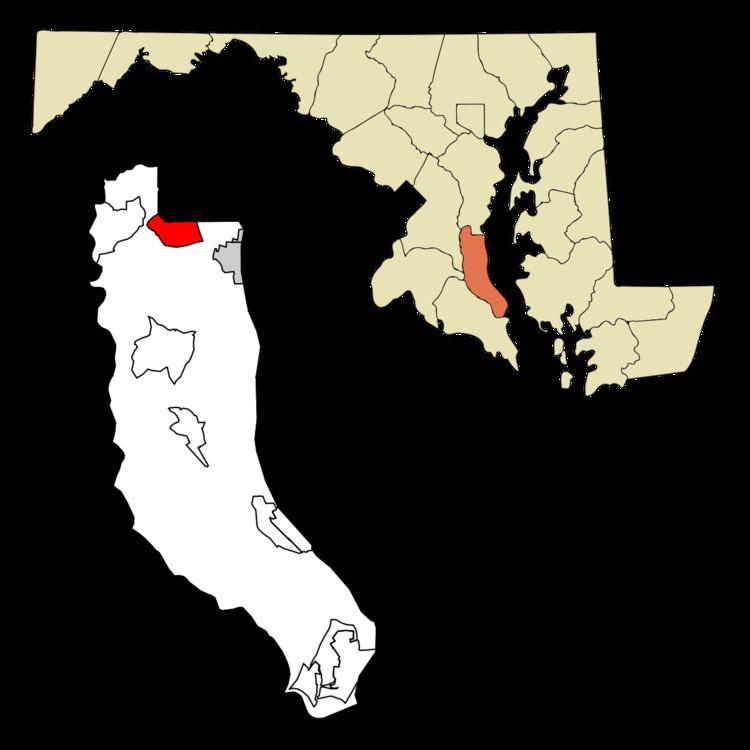
Owings is a census-designated place (CDP) in Calvert County, Maryland, United States. The population was 2,149 at the 2010 census, up from 1,325 at the 2000 census.
Contents
Map of Owings, MD 20736, USA
Geography
Owings is located along the northern border of Calvert County at 38°42′43″N 76°36′14″W (38.711919, -76.603901). It is bordered to the north by Friendship in Anne Arundel County. Maryland Route 2 (Solomons Island Road) passes through the CDP west of the center of town, leading north 23 miles (37 km) to Annapolis and south 13 miles (21 km) to Prince Frederick, the Calvert County seat. Maryland Route 260 passes through the center of town and leads southeast 4 miles (6 km) to Chesapeake Beach and northwest 11 miles (18 km) to Upper Marlboro, via MD 4.
According to the United States Census Bureau, the Owings CDP has a total area of 3.9 square miles (10.2 km2), of which 0.01 square miles (0.03 km2), or 0.32%, is water.
The Owings area is considered exurban by the Washington Post. It includes a mix of farmland, single-family detached homes and subdivisions. Aerial maps show that about 50% of the Owings CDP is wooded. The place center lies on the former Chesapeake Beach Railway line, which was converted to the roadway Maryland Route 260. Owings was a stop on the railway local service. Hall Creek originates in the Owings vicinity, forms part of the CDP's northern border and winds west until it empties into the Patuxent River. The creek bed cuts a significant valley across the hilly central ridge of the Calvert County peninsula.
Demographics
As of the census of 2000, there were 1,325 people, 426 households, and 356 families residing in the CDP. The population density was 337.2 people per square mile (130.2/km²). There were 443 housing units at an average density of 112.7/sq mi (43.5/km²). The racial makeup of the CDP was 86.87% White, 11.47% African American, 0.15% Native American, 0.60% Asian, 0.45% from other races, and 0.45% from two or more races. Hispanic or Latino of any race were 0.75% of the population.
There were 426 households out of which 42.3% had children under the age of 18 living with them, 71.8% were married couples living together, 8.2% had a female householder with no husband present, and 16.4% were non-families. 10.8% of all households were made up of individuals and 3.5% had someone living alone who was 65 years of age or older. The average household size was 3.06 and the average family size was 3.30.
In the CDP, the population was spread out with 29.7% under the age of 18, 5.5% from 18 to 24, 29.9% from 25 to 44, 25.9% from 45 to 64, and 9.1% who were 65 years of age or older. The median age was 38 years. For every 100 females there were 96.6 males. For every 100 females age 18 and over, there were 89.4 males.
The median income for a household in the CDP was $74,150, and the median income for a family was $74,702. Males had a median income of $49,250 versus $31,204 for females. The per capita income for the CDP was $27,287. About 2.5% of families and 3.5% of the population were below the poverty line, including none of those under age 18 and 9.5% of those age 65 or over.
History
Originally the Chesapeake Beach Railway station at the line's intersection with Solomons Island Road was known as "Friendship". David Moffatt, president of the railway, renamed the station "Owings" in order to avoid conflict with the town of West Friendship, Maryland. The name was a tribute to Harry P. Owings, a one-time member of the state legislature and Calvert County resident, who was also a local farmer and real estate agent. In August 1900, Harry P. Owings requested the position of station manager. The station was already known as Owings at the time of the request.
Maidstone was listed on the National Register of Historic Places in 1971.