
Canton Nérondes Area 24.64 km² | Population 667 (1999) | |
 | ||
Ourouer-les-Bourdelins is a commune in the Cher department in the Centre region of France.
Contents
Map of 18350 Ourouer-les-Bourdelins, France
Geography
A farming area comprising the village and a couple of hamlets situated some 21 miles (34 km) southeast of Bourges, at the junction of the D6 with the D15 and D109 roads. The river Airain forms all of the commune's northwestern boundary.
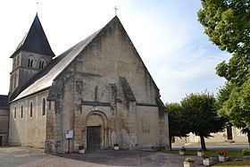
Sights
References
Ourouer-les-Bourdelins Wikipedia(Text) CC BY-SA