
- average 1 m/s (35 cu ft/s) Discharge 1 m³/s Basin area 100 km² | Length 27 km Area 100 km² | |
 | ||
Bougeotte promo large file
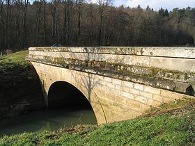
The Ougeotte is a 27.3 km river in the department of Haute-Saône in the region of Franche-Comté in the eastern France. It is a sub-tributary of the Rhône via the Saône.
Contents
L ve toi et bouge 2013 zumbatomic
GeographyEdit
The Ougeotte rises in Ouge, which gives its name to the river. It flows generally east, receiving the Gailley at Chauvirey-le-Vieil, then the Écrevisses stream on the right of the ancient Agneaucourt mill, then joining the Saône at Gevigney-et-Mercey near Montureux-lès-Baulay.
Nowadays there are no more mills which take power from the Ougeotte, while at the beginning of the 19th century there were many:
In the 1840s, the Ougeotte was populated by burbot, pike, eel and perch. By 1960, it was fished for trout and crayfish.
References
Ougeotte Wikipedia(Text) CC BY-SA