
Population 654 (2011) Unitary authority Local time Tuesday 12:16 AM | OS grid reference NY885935 Sovereign state United Kingdom Dialling code 01830 | |
 | ||
Weather 6°C, Wind E at 10 km/h, 91% Humidity | ||
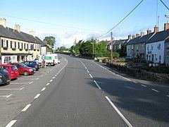
Otterburn is a small village in Northumberland, England, 31 miles (50 km) northwest of Newcastle Upon Tyne on the banks of the River Rede, near the confluence of the Otter Burn, from which the village derives its name. It lies within the Cheviot Hills about 16 miles (26 km) from the Scottish border. The parish of Otterburn is at the heart of Redesdale, a remote Northumbrian upland valley steeped in history and blessed with natural beauty.
Contents
Map of Otterburn, Newcastle upon Tyne, UK
History
The name simply means otter stream, a stream frequented by otters (Old English "otor" + "brunna"). Otterburn was the site of a major battle in 1388 between English and Scottish armies. The engagement, in which the Scots took Sir Henry Percy captive, is the subject of the English ballad Chevy Chase and the Scots ballad Otterburn.
The battle of Otterburn ended in an English rout. Despite James Douglas, 2nd Earl of Douglas being killed, Percy was captured and over a thousand of the English were taken, left dead on the field or slain as they fled. The dead were carried to Elsdon church, 3 miles (4.8 km) from Otterburn, where they were buried.
The modern village grew up around a coaching inn and Otterburn Tower. It was enlarged in the 1950s with the addition of Brierley Gardens, a council estate which was expanded in the 1970s. The village further expanded in the 1990s and 2000s with the new housing development on former farm land at Willow Green.
Governance
Otterburn is in the parliamentary constituency of Hexham.
Economy
Today, the village is noted for its proximity to the Otterburn Training Area, one of the UK's largest army training ranges at some 60,000 acres (240 km2). The village also has an independent general grocery shop, two hotels and Otterburn Mill, an 18th-century Woollen Mill containing a small museum, outdoor shop and cafe.