
Elevation 1,703 m | ||
 | ||
People also search for Alamo Mountain, Wind Mountain, Cornudas Mountain, North Oscura Peak | ||
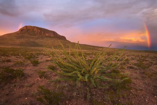
Otero mesa southern new mexico
Otero Mesa is a 1.2 million acre (4,900 km²) area in northern Chihuahuan Desert region of southern New Mexico. Between 1954 and 1965 the U.S. Army expanded its McGregor Range facilities at Fort Bliss onto Otero Mesa by purchasing ranches. In 2005, the Bureau of Land Management approved the area for exploratory drilling for oil and gas, but that approval is currently being litigated by the state of New Mexico and environmental groups who want the mesa to be recognized as protected wilderness.
Contents
Map of Otero Mesa, New Mexico, USA
On Tuesday, April 28, 2009, the Court of Appeals for the Tenth Circuit ruled against the US Bureau of Land Management plan for leasing the Otero Mesa for oil and gas extraction. The court found that the BLM had failed to consider an alternative that would leave the Otero Mesa unleased, and also failed to examine potential impacts to the underlying groundwater. The oil company HEYCO had been granted a lease for extracting natural gas form Otero Mesa, pending the outcome of the litigation.
The United States Department of the Interior has proposed creating an Otero Mesa as a National Monument, but it remains controversial, and President Barack Obama has not taken action on the proposal under the Antiquities Act of 1906 as of February 2010.