
 | ||
Osoblaha osobla sko na kole
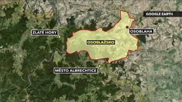
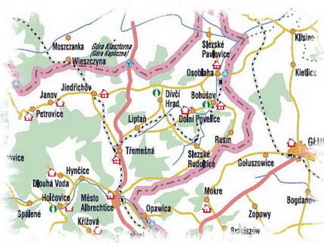
Osoblažsko (literally Osoblaha region, Czech: Osoblažsko, German: Hotzenplotzer Ländchen, Polish: ziemia osobłoska) is a microregion is situated in the northernmost part of the Moravian-Silesian Region of Czech Republic. This microregion is so-called Osoblaha Hook (Czech: osoblažský výběžek, German: Hotzenplotzer Zipfel, Polish: cypel osobłoski) or Silesian Hanakia (Czech: Slezská Haná, German: Schlesiche Hanna, Polish: Śląska Hana).[1] It is bounded by mountain ridges of Jeseníky mountains from the west and the Polish border from the east and north. A voluntary association of municipalities – The Association of Municipalities of Osoblažsko was established to solve the drinking water supply problem of the region in 1990s and was restored in 2002 focusing mainly on solution of common problems reaching beyond the grasp of individual municipalities as well as the common regional development and cross-border cooperation. The microregion currently has a population of 10,273 covering almost 290 km2. The Association of Municipalities of Osoblažsko consists of 14 municipalities:
Contents
- Osoblaha osobla sko na kole
- Bla en osobla sko dokument z t bora na osobla sku hnut duha jesen ky
- History
- Present
- Additional Populated Villages
- Top 10 tourist destinations in Osoblasko
- References
Bla en osobla sko dokument z t bora na osobla sku hnut duha jesen ky
History

The area of Osoblažsko region was settled first by the Slavic population but the Tartar invasion in 1241 and the invasion of Russian-Polish troops in 1253 halted the population ratios of Osoblažsko so severely that in the middle of the 13th century the Bishop Bruno of Schaumburg (Osoblažsko belonged to Olomouc bishops that is why it formed so-called „Moravian enclave“ in Silesia until 1928) invited colonists with German origin from Saxony and Brandenburg in order to populate this region. Some villages were renewed and some founded new under his leadership. After the Thirty Years' War the Czech population decreased in the region and the population mainly consisted of German speaking people (including Jews). A deep scar to the region was inflicted by Austro-Prussian Wars resulting in dividing Silesia and setting the new border bounding of Osoblažsko in 1742. Economic ties gradually built for hundreds of years were cut off and from this point Osoblažsko region slowly recedes into the bad peripheral economic situation. Agriculture continues to dominate its economy although there is an industrial revolution developing in its surroundings. Peripheral situation in the time is confirmed by the railway from Třemešná to Osoblaha built in 1898 – more than 25 years later than the railway from Krnov to Jeseník and more importantly using a narrow-gauge and constructing it on a contour line to save costs.
Hegemony of the German population in Osoblažsko was partially disrupted by the arrival of the Czechs in 1918 when the newly formed Czechoslovak Republic sent out the Czech government employees to border regions with whom come the whole families. Czechs and Germans created a relatively peaceful atmosphere until the behaviour of Germans was radicalized in connection with Adolf Hitler power accession in Germany. Osoblažsko as a part of the Sudetenland was relegated to Germany in October 1938. More changes in ethnic composition were caused by the end of World War II when the German population was forced to leave the country. The region was then repopulated by inland Czechs, Volhynian Czechs from today's Ukraine, Slovaks and Greeks. Because of the Osoblaha municipalities were severely damaged during World War II and there were no industrial companies in the area, the repopulation was insufficient – as there were nearly 23,000 people living there before the World War II, currently the region has a population of little over 10,000.
Present
Consequences of the German population transfer are visible in the countryside even today. The Osoblažsko population density is 35 inhabitants per km2 which is well below the Czech average value as the national value is more than 3.5 times higher. Thus the probability of coming across a man in this region is 3.5 times lower than in the rest of the Czech Republic which makes the region rather sleepy, lonely and melancholy, offering a man to stop and think not only about himself but also about the dramatic region history which experience the taste of ethnic and nationalist strifes – 1742 – the region was divided by the war conflict, 1938 – Czechs were force out by Germans, after 1945 – Czechs displaced Sudeten Germans.
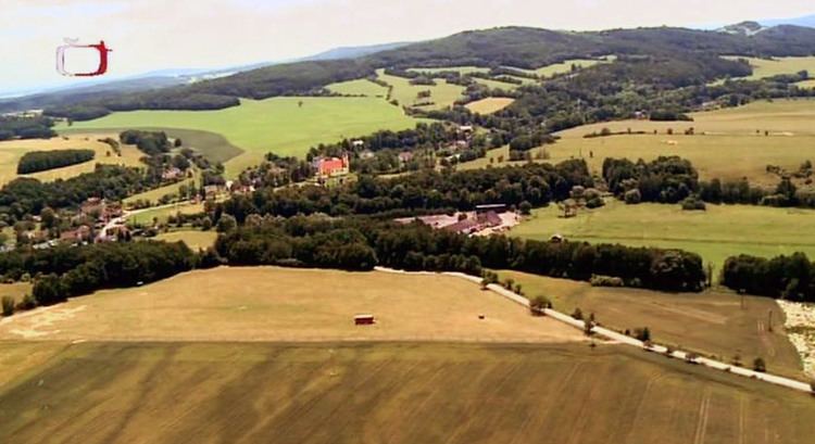
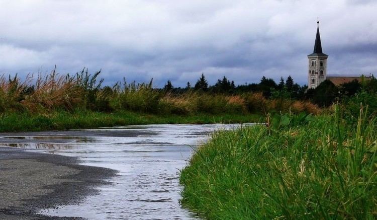
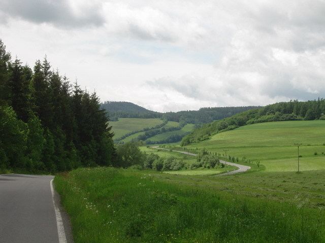
Insufficiently repopulated villages gradually disappear, yet they are not disappearing without a trace – there are overgrown gardens or remnants of houses left in their places. Walking through such villages i.e. Kašnice, Pelhřimovy, Studnice, Nový Les) offers a strong experience. Peripheral localisation of Osoblažsko region and the insufficient area population is the cause of small size villages. Together with the halted industry development these factors have preserved high quality natural conditions. The countryside of Osoblažsko forms a harmonic unit emphasised by the territory diversity – the western part belongs to the Zlatohorská Upland (a part of the Eastern Sudetes) with its mountainous character with large forested areas while the easternmost part of the Osoblaha Plain (a part of the Silesian Lowlands) is flat.
Osoblažsko is one of the poorest regions of the Czech Republic and suffers from the highest unemployment rate in the country (28.2%). [2]
The microregion is attractive for tourism – Osoblažsko is interlaced with dense network of cycle paths and hiking trails with developing follow up services. The main microregion attraction is undoubtedly the narrow-gauge railway from Třemešná to Osoblaha where in addition to regular public transport, tourist rides with the steam locomotive are operated. A ride on this train through small villages and idyllic Osoblažsko countryside offers surely an unforgettable experience.
Additional Populated Villages
In addition to the 14 cities mentioned above, the following communities are located in Osoblažsko:
Top 10 tourist destinations in Osoblažsko
1. Narrow-gauge railway from Třemešná to Osoblaha
2. Jewish cemetery in Osoblaha
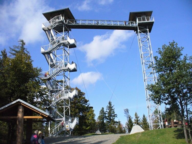
3. Biskupská kupa viewing tower (Petrovice)
4. Chateaus in Linhartovy, Jindřichov, Dívčí Hrad and Slezské Rudoltice and Fulštejn Castle ruins with recreation area below (Bohušov)
5. Abandoned Pelhřimovy municipality with Church of St. George and baroque chapel
6. Landscape around Petrovice and Janov
7. Museum in Janov
8. Swimming pools in Město Albrechtice and Osoblaha
9. Idyllic villages of Horní Povelice, Bučávka, Hrozová and Piskořov
10. Eldorádo Hynčice – „the first Dinopark in the Czech Republic“