
Country United States FIPS code 29-55424 Area 47 ha Local time Monday 6:39 AM | Time zone Central (CST) (UTC-6) GNIS feature ID 0723869 Elevation 252 m Population 47 (2013) | |
 | ||
Weather 8°C, Wind N at 11 km/h, 98% Humidity | ||
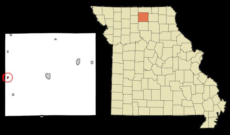
Osgood is a village in Sullivan County, Missouri, United States. The population was 48 at the 2010 census.
Contents
Map of Osgood, MO 64641, USA
History
Osgood was platted in 1886. and most likely named after a railroad man. A post office called Osgood was established in 1888, and remained in operation until 1965.
Geography
Osgood is located at 40°11′57″N 93°20′56″W (40.199175, -93.348822).
According to the United States Census Bureau, the village has a total area of 0.18 square miles (0.47 km2), all of it land.
2010 census
As of the census of 2010, there were 48 people, 19 households, and 11 families residing in the village. The population density was 266.7 inhabitants per square mile (103.0/km2). There were 31 housing units at an average density of 172.2 per square mile (66.5/km2). The racial makeup of the village was 64.6% White, 14.6% Native American, 18.8% from other races, and 2.1% from two or more races. Hispanic or Latino of any race were 20.8% of the population.
There were 19 households of which 21.1% had children under the age of 18 living with them, 26.3% were married couples living together, 15.8% had a female householder with no husband present, 15.8% had a male householder with no wife present, and 42.1% were non-families. 42.1% of all households were made up of individuals and 15.8% had someone living alone who was 65 years of age or older. The average household size was 2.53 and the average family size was 3.18.
The median age in the village was 37 years. 22.9% of residents were under the age of 18; 8.4% were between the ages of 18 and 24; 33.4% were from 25 to 44; 23% were from 45 to 64; and 12.5% were 65 years of age or older. The gender makeup of the village was 52.1% male and 47.9% female.
2000 census
As of the census of 2000, there were 51 people, 20 households, and 14 families residing in the village. The population density was 277.0 people per square mile (109.4/km²). There were 26 housing units at an average density of 141.2/sq mi (55.8/km²). The racial makeup of the village was 94.12% White, 3.92% African American, 1.96% from other races. Hispanic or Latino of any race were 1.96% of the population.
There were 20 households out of which 45.0% had children under the age of 18 living with them, 45.0% were married couples living together, 25.0% had a female householder with no husband present, and 30.0% were non-families. 20.0% of all households were made up of individuals and 20.0% had someone living alone who was 65 years of age or older. The average household size was 2.55 and the average family size was 2.93.
In the village, the population was spread out with 35.3% under the age of 18, 5.9% from 18 to 24, 27.5% from 25 to 44, 13.7% from 45 to 64, and 17.6% who were 65 years of age or older. The median age was 36 years. For every 100 females there were 88.9 males. For every 100 females age 18 and over, there were 65.0 males.
The median income for a household in the village was $14,250, and the median income for a family was $32,917. Males had a median income of $23,750 versus $17,500 for females. The per capita income for the village was $8,889. None of the population and none of the families were below the poverty line.