
Country United States County St. Joseph Time zone Eastern (EST) (UTC-5) Elevation 225 m Local time Monday 7:03 AM Area code 574 | State Indiana FIPS code 18-57114 Zip code 46561 Population 2,460 (2013) | |
 | ||
Weather 9°C, Wind W at 13 km/h, 96% Humidity Area 3.548 km² (3.522 km² Land / 3 ha Water) | ||
Osceola is a town in Penn Township, St. Joseph County, in the U.S. state of Indiana. The population was 2,463 at the 2010 Census. It is part of the South Bend–Mishawaka, IN-MI, Metropolitan Statistical Area.
Contents
- Map of Osceola IN 46561 USA
- History
- Geography
- Demographics
- 2010 census
- 2000 census
- Transportation
- References
Map of Osceola, IN 46561, USA
History
Osceola was platted in 1837. The town was named after Osceola, leader of the Seminole. A post office has been in operation at Osceola since 1854.
Geography
Osceola is located at 41°39′49″N 86°4′31″W (41.663474, -86.075205).
According to the 2010 census, Osceola has a total area of 1.37 square miles (3.55 km2), of which 1.36 square miles (3.52 km2) (or 99.27%) is land and 0.01 square miles (0.03 km2) (or 0.73%) is water.
Demographics
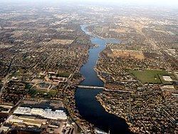
Located in the Penn-Harris-Madison School Corporation, Osceola spans both sides of the St. Joseph River, although the majority is on the south side. Osceola is divided once again by the railroad.
2010 census
As of the census of 2010, there were 2,463 people, 905 households, and 672 families residing in the town. The population density was 1,811.0 inhabitants per square mile (699.2/km2). There were 979 housing units at an average density of 719.9 per square mile (278.0/km2). The racial makeup of the town was 95.5% White, 1.4% African American, 0.2% Native American, 0.7% Asian, 0.2% Pacific Islander, 0.3% from other races, and 1.7% from two or more races. Hispanic or Latino of any race were 2.1% of the population.
There were 905 households of which 39.4% had children under the age of 18 living with them, 54.9% were married couples living together, 12.8% had a female householder with no husband present, 6.5% had a male householder with no wife present, and 25.7% were non-families. 19.4% of all households were made up of individuals and 7.3% had someone living alone who was 65 years of age or older. The average household size was 2.72 and the average family size was 3.09.
The median age in the town was 35.7 years. 27.4% of residents were under the age of 18; 7.4% were between the ages of 18 and 24; 28.8% were from 25 to 44; 25.4% were from 45 to 64; and 10.9% were 65 years of age or older. The gender makeup of the town was 50.6% male and 49.4% female.
2000 census
As of the census of 2000, there were 1,859 people, 714 households, and 521 families residing in the town. The population density was 1,361.2 people per square mile (523.9/km²). There were 739 housing units at an average density of 541.1 per square mile (208.3/km²). The racial makeup of the town was 97.79% White, 0.43% African American, 0.11% Asian, 0.75% from other races, and 0.91% from two or more races. Hispanic or Latino of any race were 0.70% of the population.
There were 714 households out of which 33.6% had children under the age of 18 living with them, 57.3% were married couples living together, 11.5% had a female householder with no husband present, and 27.0% were non-families. 21.4% of all households were made up of individuals and 8.5% had someone living alone who was 65 years of age or older. The average household size was 2.60 and the average family size was 3.01.
In the town, the population was spread out with 25.9% under the age of 18, 8.2% from 18 to 24, 29.3% from 25 to 44, 24.1% from 45 to 64, and 12.5% who were 65 years of age or older. The median age was 38 years. For every 100 females there were 101.6 males. For every 100 females age 18 and over, there were 99.7 males.
The median income for a household in the town was $43,657, and the median income for a family was $45,707. Males had a median income of $33,036 versus $25,000 for females. The per capita income for the town was $18,051. About 3.4% of families and 3.7% of the population were below the poverty line, including 4.7% of those under age 18 and 4.7% of those age 65 or over.
Transportation
Since fall 2009, Interurban Trolley's Bittersweet/Mishawaka route has connected Osceola to the nearby cities of Elkhart and Mishawaka. Riders can transfer to South Bend-Mishawaka region's TRANSPO bus system in Mishawaka and other Interurban Trolley bus routes at Elkhart.