
Founded 1680 Time zone PST (UTC+8) Local time Monday 5:51 AM | Barangays Area 65.41 km² | |
 | ||
Weather 25°C, Wind N at 0 km/h, 82% Humidity Neighborhoods Sabatan, Puting Buhangin, Wakas, General Lim | ||
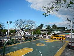
Orion, officially the Municipality of Orion (Filipino: Bayan ng Orion; Kapampangan: Balen ning Orion), is a municipality in the province of Bataan in the Central Luzon (Region III) of the Philippines. The population was 56,002 at the 2015 census. In the 2016 electoral roll, it had 36,335 registered voters.
Contents
- Map of Orion Bataan Philippines
- Geography
- Barangays
- Demographics
- Atrractions
- Festivals
- Notable people from Orion
- References
Map of Orion, Bataan, Philippines
Orion is accessible via the Bataan Provincial Expressway, off Exit 40.
Geography
Orion is located at 14°37′N 120°35′E.
According to the Philippine Statistics Authority, the municipality has a land area of 65.41 square kilometres (25.25 sq mi) constituting 7000476000000000000♠4.76% of the 1,372.98-square-kilometre- (530.11 sq mi) total area of Bataan.
Barangays
Orion is politically subdivided into 23 barangays.
Demographics
In the 2015 census, Orion had a population of 56,002. The population density was 860 inhabitants per square kilometre (2,200/sq mi).
In the 2016 electoral roll, it had 36,335 registered voters.
Atrractions
Festivals
Orion celebrates the feast of Saint Michael (Apo Ige) every 8th day of May, when balikbayans come to join in the festivities. Majority of its residents are OFWs in the United States, Japan, Europe, Australia, Canada and the Middle East.