
Existed: 2003 – present Constructed 2003 | Length 30.45 km | |
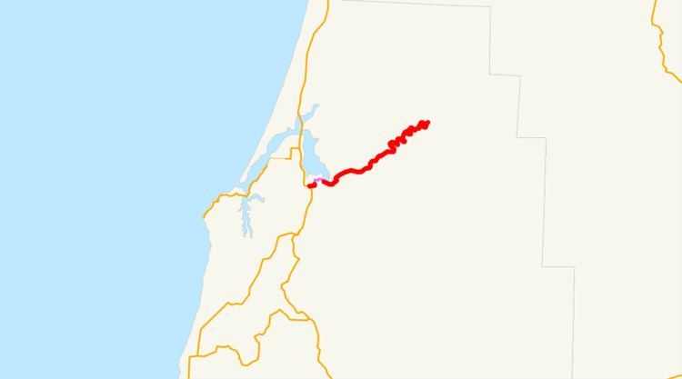 | ||
Oregon Route 241 (OR 241) is an Oregon state highway running from U.S. Route 101 (US 101) in Coos Bay to Nesika County Park in Coos County. OR 241 is known as the Coos River Highway No. 241 (see Oregon highways and routes). It is 18.94 miles (30.48 km) long and runs east–west, entirely within Coos County.
Contents
Map of Hwy 241, Coos Bay, OR 97420, USA
OR 241 was established as part of Oregon's project to assign route numbers to highways that previously were not assigned, and, as of August 2008, was unsigned.
Route description
OR 241 begins at the intersection of US 101 and Newport Avenue in an area known as Bunker Hill just south of Coos Bay. It travels east along Newport Avenue into Coos Bay and turns north onto 6th Avenue and east on D Street to leave Coos Bay. (The route is locally maintained within Coos Bay city limits.) OR 241 turns northeast again as it leaves Coos Bay, and travels through Allegany to just east of Nesika County Park, where it ends. A county road continues to Golden and Silver Falls State Park.
History
OR 241 was assigned to the Coos River Highway on January 15, 2003. As of July 2008, OR 241 was not signed with route markers.
Major intersections
Milepoints are as reported by ODOT and do not necessarily reflect current mileage. Z indicates overlapping mileage due to construction longer than established route, and – indicates negative mileage behind established beginning point. For routes traversing multiple named state highways, each milepoint is preceded by the corresponding state highway number. The entire route is in Coos County.