
Existed: 1935 – present Constructed 1935 | Length 50.32 km | |
 | ||
Oregon Route 229 is an Oregon state highway that runs along the lower reaches of the Siletz River, on the central Oregon coast. The highway is also known as the Siletz Highway No. 181 (see Oregon highways and routes).
Contents
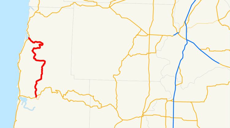
Map of OR-229, Oregon, USA
Route description
Oregon Route 229 begins (at its southern terminus) at a junction with U.S. Route 20 and U.S. Route 20 Business, north of the city of Toledo. It heads north from there, past Olalla Reservoir, meeting the Siletz River in the town of Siletz. From there, it continues north, generally following the course of the river downstream (and crossing it several times), eventually turning west and heading towards the Pacific Ocean. Close to the end of the road is the historic town of Kernville; shortly after, OR 229 ends at an intersection with U.S. Route 101, located between Lincoln City and Gleneden Beach.
The route runs entirely within Lincoln County. Due to its close proximity to the Siletz River certain sections of the roadway have been constantly plagued with erosion problems, and sections of the road are frequently washed out in winter due to flooding. Because of these issues, the State has been trying to turn the Highway over to Lincoln County, however, the County has said they are not interested in taking over Maintenance of the route unless the state fixes the problems with the road.