
Length 67.42 km | ||
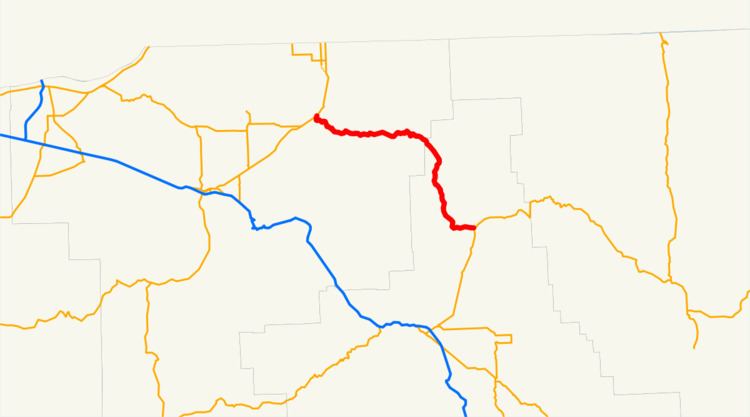 | ||
Oregon Route 204 (OR 204) is an Oregon state highway running from OR 11 in Weston to OR 82 in Elgin. OR 204 is known as the Westin-Elgin Highway No. 330 (see Oregon highways and routes). It is 41.89 miles (67.42 km) long and runs east–west.
Contents
Map of OR-204, Oregon, USA
Route description
OR 204 begins at an intersection with OR 11 at Weston and heads east to Tollgate. At Tollgate, it curves southward until shortly before Elgin, where it turns east and terminates at an intersection with OR 82.
The highway serves the Spout Springs Ski Area, near Tollgate.
History
The Weston-Elgin Highway was constructed between 1915 and 1938 to replace lower-quality private roads that had previously connected the two cities.
Major intersections
Milepoints are as reported by ODOT and do not necessarily reflect current mileage. Z indicates overlapping mileage due to construction longer than established route, and – indicates negative mileage behind established beginning point. For routes traversing multiple named state highways, each milepoint is preceded by the corresponding state highway number.