
Existed: 2002 – present Length 30.95 km | Constructed 2002 | |
 | ||
West end: Crystal Creek Loop in Eddyville | ||
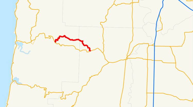
Oregon Route 180 is an Oregon state highway running from the community of Eddyville to U.S. Route 20 in Blodgett. OR 180 is known as the Eddyville-Blodgett Highway No. 180 (see Oregon highways and routes). It is 19.23 miles (30.95 km) long and runs east–west.
Contents
Map of OR-180, Oregon, USA
OR 180 was established in 2002 as part of Oregon's project to assign route numbers to highways that previously were not assigned, and, as of September 2010, was unsigned.
Route description
OR 180 begins at an intersection with Crystal Creek Loop (formerly US 20) in Eddyville. It heads east through Nortons, Nashville, and Summit to an intersection with US 20 in Blodgett, where it ends.
History
OR 180 was assigned to the undesignated part of the Eddyville-Blodgett Highway in 2002.
Related routes
References
Oregon Route 180 Wikipedia(Text) CC BY-SA