
Country Poland Car plates OPO Voivodeship Opole Voivodeship | Seat Opole Area 1,587 km² Capital Opole | |
 | ||
Gminas Total 13
Gmina Chrząstowice
Gmina Dąbrowa
Gmina Dobrzeń Wielki
Gmina Komprachcice
Gmina Łubniany
Gmina Murów
Gmina Niemodlin
Gmina Ozimek
Gmina Popielów
Gmina Prószków
Gmina Tarnów Opolski
Gmina Tułowice
Gmina Turawa Colleges and Universities University of Opole, Opole University of Technology Points of interest Opole Zoo, Museum des Oppelner, Muzeum Polskiej Piosenki, Centralne Muzeum Jeńców, Park Linowy KanYon | ||
Opole County (Polish: powiat opolski) is a unit of territorial administration and local government (powiat) in Opole Voivodeship, south-western Poland. It came into being on January 1, 1999, as a result of the Polish local government reforms passed in 1998. Its administrative seat is the city of Opole, although the city is not part of the county (it constitutes a separate city county). The county contains three towns: Ozimek, 20 km (12 mi) east of Opole, Niemodlin, 24 km (15 mi) west of Opole, and Prószków, 11 km (7 mi) south-west of Opole.
Contents
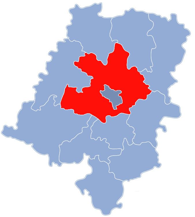
Map of Opole County, Poland
The county covers an area of 1,586.82 square kilometres (612.7 sq mi). As of 2006 its total population is 134,874, out of which the population of Ozimek is 9,944, that of Niemodlin is 6,849, that of Prószków is 2,713, and the rural population is 115,368.
Neighbouring counties
Apart from the city of Opole, Opole County is also bordered by Namysłów County and Kluczbork County to the north, Olesno County to the north-east, Strzelce County to the south-east, Krapkowice County and Prudnik County to the south, Nysa County to the south-west, and Brzeg County to the north-west.
Administrative division
The county is subdivided into 13 gminas (three urban-rural and 10 rural). These are listed in the following table, in descending order of population.