
Population 277 (2011 census) Time zone AEST (UTC+10) Postal code 2316 | Postcode(s) 2316 Area 4.7 km² Local time Saturday 9:33 AM | |
 | ||
Location 202 km (126 mi) NNE of Sydney55 km (34 mi) NE of Newcastle41 km (25 mi) ENE of Raymond Terrace Weather 21°C, Wind NW at 3 km/h, 79% Humidity | ||
One Mile is a suburb of the Port Stephens local government area in the Hunter Region of New South Wales, Australia. The suburb is semi-rural with a small urban settlement west of Gan Gan Road, a residential park (Middlerock Home Village) and a number of caravan parks to the east of Gan Gan Road. The parks are positioned to provide quick access to the suburb's two beaches.
Map of One Mile NSW 2316, Australia
One Mile Beach, after which the area was named, is a family-friendly surf beach that is popular with tourists while Samurai Beach is clothing optional. Both beaches, like a large percentage of the locality, lie within the Tomaree National Park. The beaches form most of the coastline in Anna Bay which gave the adjacent suburb of Anna Bay its name.
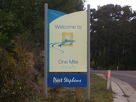
Although the suburb is formally called One Mile residents often refer to it as One Mile Beach. Even some road signs identify the area incorrectly as One Mile Beach.