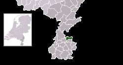
Elevation 68 m (223 ft) Postcode 6447–6456 Area 21.24 km² | Established 1 January 1982 Time zone CET (UTC+1) Area code 045, 046 Local time Friday 9:02 PM | |
 | ||
Weather 10°C, Wind NE at 16 km/h, 62% Humidity | ||
Onderbanken ( [ˈɔndərˌbɑŋkə(n)]; Limburgish: Óngerbenk) is a municipality in the southeastern Netherlands.
Contents
Map of Onderbanken, Netherlands
Population centres
Bingelrade, Douvergenhout, Etzenrade, Jabeek, Merkelbeek, Op den Hering, Quabeek, Raath, Schinveld, Viel.
Dutch Topographic map of the municipality of Onderbanken, June 2015.
References
Onderbanken Wikipedia(Text) CC BY-SA
