
Population 329 (2011) Civil parish Ollerton Local time Friday 5:50 AM | OS grid reference SJ776767 Unitary authority Dialling code 01565 | |
 | ||
Weather 3°C, Wind NE at 11 km/h, 88% Humidity | ||
Ollerton is a village in the Borough of Cheshire East and the ceremonial county of Cheshire, England. It is situated approximately 2 miles (3.2 km) south east of the town of Knutsford, and has a population of 323, rising marginally to 329 at the 2011 Census.
Map of Ollerton, Knutsford, UK
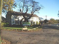
Local services are limited, and include a church which is within Marthall, pub and several postboxes. Other services such as the primary school, post office and shop have closed down, due to many residents using services in Knutsford. Ollerton combined with the adjacent village of Marthall, has a joint parish council, elected every 3 years, though having very limited and symbolic powers. The villages share the new village hall in Marthall, which was constructed in November 2009.
Ollerton is thought to have come from the name Owlerton and is named in the Domesday Book.