
Country United States State Mayor Michael Copeland | Population 131,885 (2013) Area 60.42 sq mi Founded 1857 | |
 | ||
Colleges and Universities MidAmerica Nazarene University, Regency Beauty Institute-Olathe, Xenon International Academy | ||
Unemployment rate 3.6% (Feb 2015) | ||
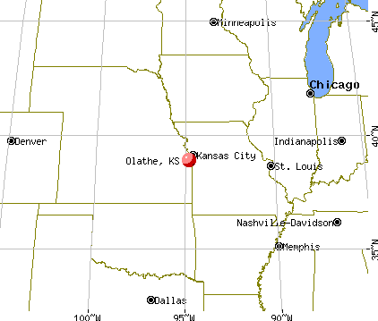
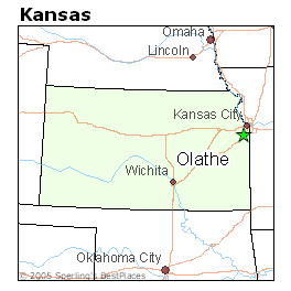
Map of Olathe, Kansas
Olathe ( ) is a city in, and is the county seat of, Johnson County, Kansas, United States. Located in northeastern Kansas, it is also the fourth most populous city in the state, with a population of 125,872 recorded by the 2010 census. Olathe is also the fourth-largest city in the Kansas City metropolitan area. It is bordered by the cities of Lenexa to the north, Overland Park to the east, De Soto to the northwest, and Gardner to the southwest.
Contents
- Map of Olathe Kansas
- Olathe ks crossroads to adventure
- Monkey bizness in olathe kansas 9137802500
- 19th century
- 20th century
- 21st century
- Geography
- Climate
- Demographics
- 2010 census
- 2000 census
- Economy
- Largest employers
- Education
- Transportation
- Notable people
- Sister cities
- Friendship cities
- References
Olathe ks crossroads to adventure
Monkey bizness in olathe kansas 9137802500
19th century
Olathe was founded by Dr. John T. Barton in the spring of 1857. He rode to the center of Johnson County, Kansas, and staked two quarter sections of land as the town site. He later described his ride to friends: "...the prairie was covered with verbena and other wild flowers. I kept thinking the land was beautiful and that I should name the town Beautiful." Purportedly, Barton asked a Shawnee interpreter how to say "Beautiful" in his native language. The interpreter responded, "Olathe."
Olathe was incorporated as a city in 1857.
While Olathe was not the first city established in Johnson County, it quickly became the largest and was named the county seat in October 1859. The city's early days were filled with violence, as pro-slavery forces from nearby Missouri often clashed with local abolitionists. These conflicts were known on a large scale as Bleeding Kansas.
As the 1850s came to a close, and as Kansas entered the Union as a free state in 1861, the violence lessened. However, a year later, Confederate guerrillas from Missouri led by William Quantrill surprised the residents and raided the city on September 7, 1862, killing a half dozen men, robbing numerous businesses and private homes, and destroying most of the city. Quantrill launched the raid because the people of Olathe were known for their abolitionism. Throughout the Civil War a military post operated in Olathe. The post probably was established in 1861 and was located on the public square on which the Johnson County Courthouse has sat since that time. In March 1862 one company of troops were known to have been stationed there. When Quantrill raided Olathe on September 6, 1862, more than 125 Union soldiers, almost all of them recruits, were there. They surrendered to Quantrill and were compelled to take an oath forbidding them from taking up arms against the Confederacy. It was decided in November that the recruits and soldiers in Olathe could not be compelled to obey oaths extracted by guerrillas, as such forces were not recognized as legitimate enemy military units.
Kansas militia occupied the Olathe military post through much of the Civil War and Army troops were there much of the time, as well. Twice more Olathe was threatened by Confederates. On August 20–21, 1863, Quantrill again passed through the area when he raided Lawrence, Kansas (see Lawrence Massacre). Many Union troops moved into and out of Olathe on those two days. The second time was on October 24-5, 1864, when Confederate Maj. Gen. Sterling Price and a force of 10,000 men passed the area on their retreat south (see Price's Raid).
The military post existed beyond the end of the Civil War, being deactivated probably in August 1865.
Olathe served as a stop on the Oregon Trail, the California Trail, and the Santa Fe Trail. Catering to travelers was the main source of income for local stores and businesses. The Mahaffie House, a popular resupply point for wagons headed westward, is today a registered historical site maintained by the City of Olathe. The staff wears period costumes, and stagecoach rides and farm animals make the site a favorite among children. Visitors can participate in Civil War re-enactments, Wild West Days, and other activities.
After the construction of the transcontinental railroad, the trails to the west lost importance, and Olathe faded into obscurity and remained a small, sleepy prairie town.
20th century
In the 1950s, the construction of the Interstate Highway system and, more directly, I-35, linked Olathe to nearby Kansas City. The result was tremendous residential growth as Olathe became a part of the Kansas City metropolitan area. In the 1980s, Olathe experienced tremendous commercial growth, which also drew more residents. It is estimated that Olathe's population surpassed 100,000 in 2001, and current projections show Olathe's growth continuing as the city expands into the farm fields south, west and north of town.
21st century
In 2008, the US Census Bureau ranked Olathe the 24th fastest-growing city in the nation. The same year, CNN/Money and Money magazine ranked Olathe #11 on its list of the "100 Best Cities to Live in the United States."
On February 22, 2017, Adam Purinton opened fire at a crowded Austins Bar and Grill in southern Olathe, shooting and injuring three people, one fatally. The victims were later identified as Alok Madasani, Srinivas Kuchibhotla and Ian Grillot. Purinton was later arrested 80 miles away in Clinton, Missouri. He was charged with one count of first-degree murder and two counts of attempted first-degree murder. This shooting gained international attention as two of the three victims were Indian.
Geography
Olathe is located at 38°52′51″N 94°48′11″W. 2003 Orthophoto Aerial According to the United States Census Bureau, the city has a total area of 60.42 square miles (156.49 km2) of which 59.66 square miles (154.52 km2) is land and 0.76 square miles (1.97 km2) is water. Olathe has two public lakes: Lake Olathe with 172 acres (0.70 km2) of water surface and Cedar Lake with 45 acres (0.18 km2).
Olathe's Black Bob Park is named after Hathawekela Shawnee Chief Black Bob.
Climate
Olathe has a humid continental climate, with cold to mild winters and hot summers. Temperatures range from an average high of 39 °F (4 °C) and low 20 °F (−7 °C) in January to an average high of nearly 90 °F (32 °C) in July. The temperature reaches 90 °F (32 °C) an average of 36 days per year and 100 °F (38 °C) an average of 3 days per year. The minimum temperature falls below freezing (32 °F) an average of 102 days per year, but rarely drops below 10 °F (−12 °C). Typically the first frost occurs between mid-October and the first week of November, and the last frost occurs between the end of March and the second week of April.
The area receives about 40 inches (1,000 mm) of precipitation during an average year with the largest share being received in May and June—the April–June period averages 30 days of measurable precipitation. During a typical year the total amount of precipitation may be anywhere from 28 to almost 53 inches. There are on average 95 days of measurable precipitation per year. Winter snowfall averages about 19 inches, but the median is 13 inches (330 mm). Measurable snowfall occurs an average of 9 days per year with at least an inch of snow being received on seven of those days. Snow depth of at least an inch occurs an average of 25 days per year.
Demographics
The median income for a household was $61,111, and the median income for a family was $68,498 (these figures had risen to $72,634 and $82,747 respectively as of a 2007 estimate). Males had a median income of $45,699 versus $30,217 for females. The per capita income for the city was $24,498. About 2.4% of families and 4.1% of the population were below the poverty line, including 4.1% of those under age 18 and 4.1% of those age 65 or over.
2010 census
As of the census of 2010, there were 125,872 people, 44,507 households, and 33,274 families residing in the city. The population density was 2,109.8 inhabitants per square mile (814.6/km2). There were 46,851 housing units at an average density of 785.3 per square mile (303.2/km2). The racial makeup of the city was 83.1% White, 5.3% African American, 0.4% Native American, 4.1% Asian, 0.1% Pacific Islander, 4.1% from other races, and 3.0% from two or more races. Hispanic or Latino of any race were 10.2% of the population.
There were 44,507 households of which 44.1% had children under the age of 18 living with them, 60.9% were married couples living together, 9.6% had a female householder with no husband present, 4.3% had a male householder with no wife present, and 25.2% were non-families. 20.0% of all households were made up of individuals and 5.3% had someone living alone who was 65 years of age or older. The average household size was 2.80 and the average family size was 3.24.
The median age in the city was 32.9 years. 30% of residents were under the age of 18; 7.5% were between the ages of 18 and 24; 32.1% were from 25 to 44; 23.1% were from 45 to 64; and 7.2% were 65 years of age or older. The gender makeup of the city was 49.5% male and 50.5% female.
2000 census
As of the census of 2000, there were 92,962 people, 32,314 households, and 24,623 families residing in the city. The population density was 1,716.4 people per square mile (662.7/km²). There were 33,343 housing units at an average density of 615.6 per square mile (237.7/km²). The racial makeup of the city was 88.63% White, 3.70% African American, 0.43% Native American, 2.74% Asian, 0.05% Pacific Islander, 2.64% from other races, and 1.80% from two or more races. Hispanic or Latino of any race were 5.44% of the population. 26.1% were of German, 11.0% Irish, 10.7% English and 9.6% American ancestry.
There were 32,314 households out of which 45.1% had children under the age of 18 living with them, 63.8% were married couples living together, 9.0% had a female householder with no husband present, and 23.8% were non-families. 18.4% of all households were made up of individuals and 3.7% had someone living alone who was 65 years of age or older. The average household size was 2.83 and the average family size was 3.24.
In the city, the population was spread out with 30.8% under the age of 18, 9.2% from 18 to 24, 36.7% from 25 to 44, 18.1% from 45 to 64, and 5.2% who were 65 years of age or older. The median age was 31 years. For every 100 females there were 99.4 males. For every 100 females age 18 and over, there were 96.1 males.
Economy
Olathe's commercial and industrial parks are home to many companies, including Honeywell, Husqvarna, ALDI, Garmin, Grundfos, and Farmers Insurance Group. Although Farmers Insurance is based in Los Angeles California, Olathe has more Farmers employees than any other city in the United States.
The Federal Aviation Administration, a sub-agency of the United States Department of Transportation, administers and maintains an Air Route Traffic Control Center in Olathe, designated Kansas City Center or ZKC. Kansas City Center is one of 20 regional Air Route Traffic Control Centers that cover United States airspace. Johnson County maintains an airport in Olathe, Johnson County Executive Airport, which is located on about 500 acres (2.0 km2) of land with a 4,100-ft (1250-m) runway, parallel taxiways, and a Federal contract air traffic control tower. The airport is the second-busiest in the state.
Largest employers
According to the City's 2015 Comprehensive Annual Financial Report, the largest employers in the city are:
Education
The city of Olathe is served by the De Soto School District, the Olathe School District, the Spring Hill school district and the Blue Valley School District. As of 2008, there are 26,894 students enrolled in the Olathe School District. The Olathe School District has 35 elementary schools, 9 middle schools, and 5 high schools: Olathe North, Olathe South, Olathe East, Olathe Northwest, and Olathe West.
Olathe is the home of MidAmerica Nazarene University and the Kansas State School For the Deaf (established in 1866).
Transportation
Notable people
Willie Aames (born Albert William Upton) is an American actor, film and television director, television producer, and screenwriter. Aames is well known for playing Tommy Bradford on the 1970s television series Eight Is Enough, Buddy Lembeck on the 1980s series Charles in Charge and Bibleman.
John Anderson, Jr. was the 36th Governor of Kansas from 1961 until 1965. He was born near Olathe.
Earl Browder, a prominent leader in the American Communist movement. He served as Chairman of the National Committee of the Communist Party USA from 1934-1945. He was also the Communist Party USA's candidate for President in the 1936 presidential election and 1940 presidential election.
Jonathan Quinn is the current head football coach for the MidAmerica Nazarene Pioneers football team. Quinn also played for the Kansas City Chiefs, Chicago Bears, and for the Berlin Thunder of NFL Europe.
Darren Sproles is an American football running back of the NFL who plays for the Philadelphia Eagles. He was drafted by the San Diego Chargers in the fourth round of the 2005 NFL Draft. He played college football at Kansas State University, and high school football at Olathe North High School.
Buddy Rogers was an American actor who played the leading role in Wings (1927) which won the first Academy Award for Best Picture in 1929. He was also a notable jazz musician and film producer. The actor was married to film legend Mary Pickford and won an Honorary Oscar in 1986.