
Country Nepal District Taplejung District Local time Thursday 8:38 PM Postal code 57508 | Zone Mechi Zone Time zone Nepal Time (UTC+5:45) Population 239 (2011) Area code 024 | |
 | ||
Weather -7°C, Wind NE at 5 km/h, 76% Humidity Neighborhoods Olangchung Gola, Yangma, Mauma, Chhija, Syao, Nup | ||
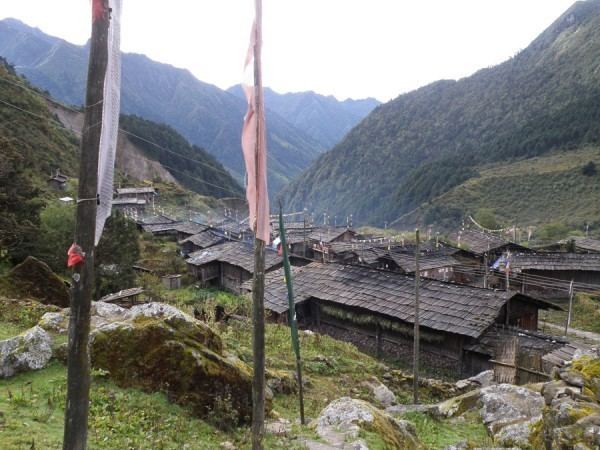
Olangchung gola real
Olangchung Gola (locally as Walung or Holung) is a village development committee in the Himalayas of Taplejung District in the Mechi Zone of north-eastern Nepal. It is located to the north of Tamor River in the mountainous area in the northwest of Taplejung District bordering Tibet, China. Lately the river flowing next to the village is gradually expanding towards the village posing a serious threat of submerging the village.
Contents
Map of Olangchung Gola, Nepal
Olangchung is surrounded by Sikkim to the east and Tibet to the north and hence was once a strategic place between Tibet, Nepal and Sikkim. The Gorkha war between Nepal and Tibet was negotiated in this tiny village. The Chogyal of Sikkim, fearing incarceration by British India, went into hiding here, ready to escape into Tibet, though he was captured later.
Olangchung Gola is the trade hub for surrounding villages such as Yangma, Ghunsa, Khangbachey, Lungthung, Lelep. Gola means "market" in the local language. In addition, historically Tipta La the pass connecting the area with Tibet was an important trade route.
People
The Walung people are the indigenous inhabitants of the region around Olangchung Gola. They are descended from Tibetan traders and practice Nyingmapa Buddhism.
At the time of the 1991 Nepal census it had a population of 422 people living in 82 individual households. According to 2011 Nepal census 239 people live in 62 individual households.