
Elevation 189 m (620 ft) Population 3,579 (2014) | Local time Friday 10:22 AM | |
 | ||
Demonym(s) Olerdolenc, olerdolencaMogenc, mogencaMolantenc, molantenca Weather 10°C, Wind N at 13 km/h, 63% Humidity Points of interest El Jardí dels Ocells, Museu d'Arqueologia de Catalu, Masía del Marqués (Casa Se | ||
Olèrdola is a municipality in the comarca of the Alt Penedès in Catalonia, Spain. It is situated on the northern side of the Garraf massif, and the highest point of the municipality is the Puig de l'Àliga at 468 m.
Contents
Map of Ol%C3%A8rdola, Barcelona, Spain
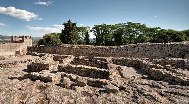
Olèrdola castle controlled the area of the Penedès Depression in the Early Middle Ages, reaching the height of its significance when its castle dominated the region under the control of the rebellious Mir Geribert, "Prince of Olèrdola". Its importance declined from the twelfth century and its administrative role was taken by Vilafranca del Penedès. The territory has been inhabited since the Neolithic period, and Iberic and Roman remains are juxtaposed with the ruins of the castle. The unusual, circular, Roman chapel of the Sant Sepulcre is near La Plana Rodona.
Subdivisions
The name of the municipality is derived from the historical castle, not from any modern settlement. Six villages and two industrial zones (polígons industrials) make up the municipality. Populations are given as of 2005: