
Work settlements 1 Urban-type settlements 1 Founded 1970 | Selsoviets 10 Area 628 km² | |
 | ||
Administrative center work settlement of Pryamitsyno | ||
Oktyabrsky District (Russian: Октя́брьский райо́н) is an administrative and municipal district (raion), one of the twenty-eight in Kursk Oblast, Russia. It is located in the center of the oblast. The area of the district is 628 square kilometers (242 sq mi). Its administrative center is the urban locality (a work settlement) of Pryamitsyno. Population: 22,569 (2010 Census); 23,877 (2002 Census); 125,296 (1989 Census). The population of Pryamitsyno accounts for 22.6% of the district's total population.
Contents
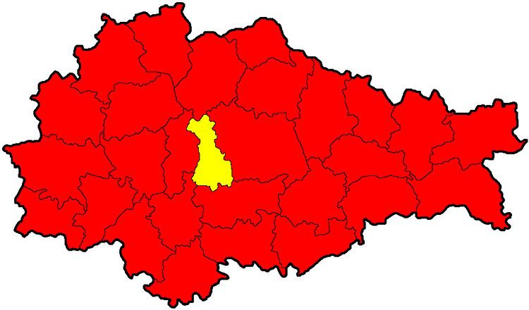
Map of Oktyabrsky District, Kurskaya Oblast, Russia
Geography
Oktyabrsky District is located in the central region of Kursk Oblast. The terrain is hilly plain on the Central Russian Upland. The main river in the district is the Seym River (which from the district flows west to the Dnieper River basin) and the Bolshaya Kuritsa, a small tributary of the Seym. The district is 10 km west of the city of Kursk and 460 km southwest of Moscow. The area measures 40 km (north-south), and 15 km (west-east). The administrative center is the town of Pryamitsyno.
The district is bordered on the north by Fatezhsky District, on the east by Kursky District, on the south by Medvensky District, and on the west by Kurchatovsky District.