
Length 32.8 km | ||
 | ||
south end: US-62/SH-10 in Ft. Gibson | ||
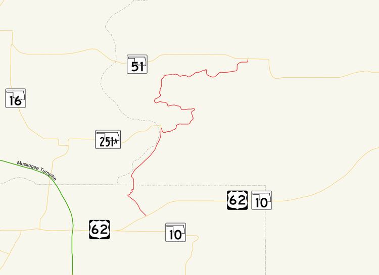
State Highway 80 is a north–south state highway in eastern Oklahoma. It runs from Ft. Gibson in Muskogee County to Hulbert in Cherokee County. It is 20.4 miles (33 km) long and has one lettered spur route, SH-80A.
Contents
Map of OK-80, Oklahoma, USA
Route description
SH-80 begins at US-62/SH-10 just south of Ft. Gibson. After heading through Ft. Gibson, it enters Cherokee County. It roughly parallels the Cherokee/Wagoner County line before meeting the east end of State Highway 251A. It then heads east before curving back north and zig-zagging to its northern end with SH-51.
SH-80A
SH-80A is an alternate route of SH-80 through the east side of Ft. Gibson. It is a half mile (0.8 km) in length. It connects to SH-80 at both ends.
References
Oklahoma State Highway 80 Wikipedia(Text) CC BY-SA