
Length 26.49 km | North end: SH-9 North end: SH-16 | |
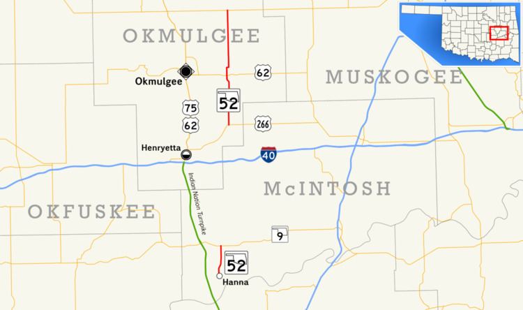 | ||
State Highway 52 (abbreviated SH-52) is two once-connected highways in the U.S. state of Oklahoma. There are no lettered spur routes from either of them.
Contents
Map of OK-52, Indianola, OK 74442, USA
Southern section
The southern SH-52 is a short, 4.06 miles (6.53 km) state highway in McIntosh County, Oklahoma. It connects State Highway 9 to the town of Hanna.
Northern section
The northern SH-52 runs for 16.46 miles (26.49 km) from US-266 northeast of Grayson to SH-16. Along the way it intersects US-62 near Morris.
History
At one time, at least as recently as 1972, the two sections of SH-52 were connected by a dirt section running from SH-9 to US-266. This section has since been decommissioned.
Southern section
The entire route is in McIntosh County.
Northern section
The entire route is in Okmulgee County.
References
Oklahoma State Highway 52 Wikipedia(Text) CC BY-SA