
Length 76.3 km | Constructed 4 August 1924 | |
 | ||
Existed: August 4, 1924 – present | ||
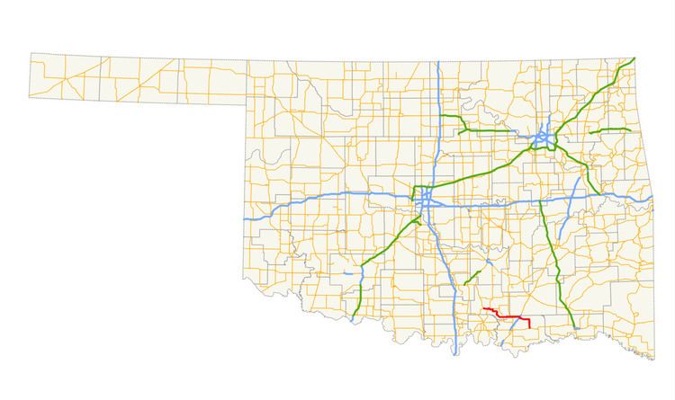
State Highway 22 (abbreviated SH-22) is a state highway in Oklahoma. It runs in a 47.4-mile (76.3 km) west-to-east pattern through the south-central part of the state, running from SH-1 at Ravia to US-70 at Bokchito. There are no letter-suffixed spur highways branching from SH-22.
Contents
Map of OK-22, Oklahoma, USA
The SH-22 designation was first established on August 4, 1924. From its original termini of Davis and Durant, the route was extended to both the east and the west, reaching its greatest extent in 1933, connecting Duncan to the Texas state line at the Red River. In 1941, the portion of SH-22 west of Ravia was dropped, and the highway's eastern terminus was set in 1956.
Route description
SH-22 begins at SH-1 in the town of Ravia, in southern Johnston County. From there, it travels three miles (4.8 km) east to US-377/SH-99, where it joins with them in a one-mile (1.6 km) concurrency to Tishomingo.
In Tishomingo, SH-78 begins, concurrent with SH-22. The two highways run east for three miles (4.8 km) before splitting from one another. SH-22 turns roughly southeast and continues for 13 miles (21 km) to its second concurrency with SH-78 at Nida (unincorporated).
From here, it runs due east for seven miles (11 km) to an intersection with SH-48, just west of Kenefic, then seven more miles to the junction with US-69/US-75 outside Caddo. From Caddo, SH-22 travels east, then south, for 13 miles (21 km) to its terminus at US-70 in Bokchito, in eastern Bryan County.
History
ROUTE NO. 22 Beginning at Durant in Bryan county, at a connection with State Highways, No. 5 and 6, via Milburn, Tishomingo, Ravia, Mill Creek, Sulphur, and Davis, to a connection with State Highway No. 4.
SH-22 once had a much longer route. When it was commissioned on August 4, 1924, it ran from Durant to Davis, the Ravia to Davis section being current SH-1 and SH-7. It ended at the original SH-4, current US-77. In 1931, it was extended west to Ratliff City, where it ended at SH-29. In 1932, SH-29 was given a new alignment to the north; SH-22 was reassigned to the old alignment. extending it to Duncan. On its other end, SH-22 was extended south from Durant, through Achille to a stub ending east of town. In January 1933, it was extended further east, to the Donham Bridge over the Red River. On December 17, 1934, the highway was rerouted over a stretch of Farm-to-Market road between Tishomingo and Nida, bypassing Milburn. This decision was reversed in 1935 (with the old alignment becoming SH-22S) but redone in 1936.
By 1939, SH-22 had been rerouted through Milburn. This time, the southern route became SH-299, which took over SH-22 between Nida and the state line. SH-22 was truncated once again on November 22, 1941, this time all the way to Ravia, the current western terminus of the route. SH-22 and SH-299 swapped places yet again in 1946, with SH-22 once again taking the southern route. In 1956, SH-22 was extended east to its current terminus at Bokchito. Other than minor realignments, the highway in 1956 was the same as it is today.