
Existed: ca. 1958 – present Length 10.54 km | ||
 | ||
South end: SH-19 northeast of Pauls Valley | ||
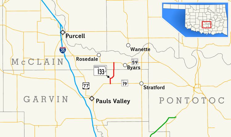
State Highway 133 (abbreviated SH-133 or OK-133) is a short 6.6-mile (10.6 km) state highway in central Oklahoma, United States. It has no lettered spur routes.
Contents
Map of OK-133, Oklahoma, USA
SH-133 was first established in the late 1950s. Originally commissioned with a gravel surface, it was paved in the 1970s.
Route description
SH-133's southern terminus is at SH-19 seven miles (11 km) northeast of Pauls Valley. The highway begins in Garvin County and crosses into McClain County 2.55 miles (4.10 km) north of SH-19. The highway ends two miles (3.2 km) north of the county line at SH-59 between Rosedale and Byars.
History
SH-133 first appeared on the 1959 state highway map, implying it was commissioned in either late 1958 or early 1959. Originally, the route was entirely gravel-surfaced but by 1963 the Garvin County portion had been paved. The road was entirely paved in 1972.