
Existed: 1958 – present Constructed 1958 | Length 21.94 km | |
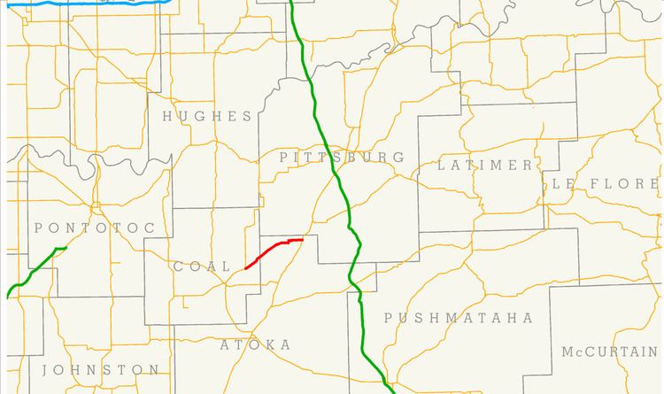 | ||
State Highway 131 (SH-131 or OK-131) is a 13.63 miles (21.94 km) state highway in southeastern Oklahoma. It runs through Coal and Atoka Counties. It has no lettered spur routes.
Contents
Map of OK-131, Oklahoma, USA
Route description
SH-131 begins in Coal County 6 miles (9.7 km) northeast of Coalgate, the county seat. From the terminus at State Highway 31, SH-131 heads northeast towards the unincorporated town of Cairo. North of Phillips Hollow, the route crosses a small stream, an eventual tributary of Coal Creek. The highway then crosses the Coal–Atoka county line.
After entering Atoka County, the highway gradually curves onto an east-northeast course, which continues as it passes through Wardville, another incorporated town 8 miles (13 km) northeast of Cairo. SH-131 then becomes a more easterly route. After bridging North Boggy Creek, the route swings around to the north briefly, before returning to a due east heading. The road then crosses Fivemile Creek. Five miles (8.0 km) east of Wardville, it ends at US-69 south of Kiowa.
History
State Highway 131 first appeared on the 1959 state road map. When it was originally commissioned, it began at its present-day western terminus near Cairo, but stopped short of the present-day eastern terminus, instead ending in Wardville. SH-131 had these termini for over twenty years. The route was extended to US-69 in 1985. No further changes to the highway have been made since the extension.