
Native name 奥入瀬川 Length 67 km | Basin size 820 km (320 sq mi) Basin area 820 km² Mouth elevation 0 | |
 | ||
River mouth HachinohePacific Ocean0 m (0 ft) | ||
Japan tohoku region oirase river valley fall foliage mvi 2242
The Oirase River (奥入瀬川, Oirase-gawa) is a river located in eastern Aomori prefecture, in the Tohoku region of northern Japan.
Contents
- Japan tohoku region oirase river valley fall foliage mvi 2242
- Map of Oirase River Japan
- oirase river
- References
Map of Oirase River, Japan
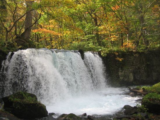
The Oirase River is the only river draining Lake Towada, a large caldera lake on the border of Aomori and Akita Prefectures. The river flows in a generally eastern direction, through the municipalities of Towada, Rokunohe, Oirase and Hachinohe before exiting into the Pacific Ocean. The upper reaches of the river form a scenic gorge with numerous rapids and waterfalls, and is one of the major tourist attractions of the Towada-Hachimantai National Park. The lower reaches of the river are used extensively for irrigation.
In 1996 the sound of flowing water at the Oirase River was selected by the Ministry of the Environment as one of the 100 Soundscapes of Japan.