
Existed: 1923 – present Length 74.32 km | Constructed 1923 | |
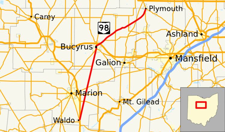 | ||
State Route 98 (SR 98) is a north–south state highway in the northern portion of the U.S. state of Ohio. Its southern terminus is at the SR 47/SR 423 concurrency in Waldo, and its northern terminus is at SR 61 in Plymouth.
Contents
Map of OH-98, Ohio, USA
SR 98 is known as Columbus-Sandusky Road along its stretch between Waldo and Bucyrus. This stretch of SR 98, in combination with US 23 south of Waldo, and SR 4 north of Bucyrus, comprises the most direct route between the two major Ohio cities of Columbus and Sandusky.
History
SR 98 was commissioned in 1923 on the same alignment as today. The entire route was paved by 1933.
References
Ohio State Route 98 Wikipedia(Text) CC BY-SA