
Existed: 1939 – present Length 18.43 km | Counties: Clinton Constructed 1939 | |
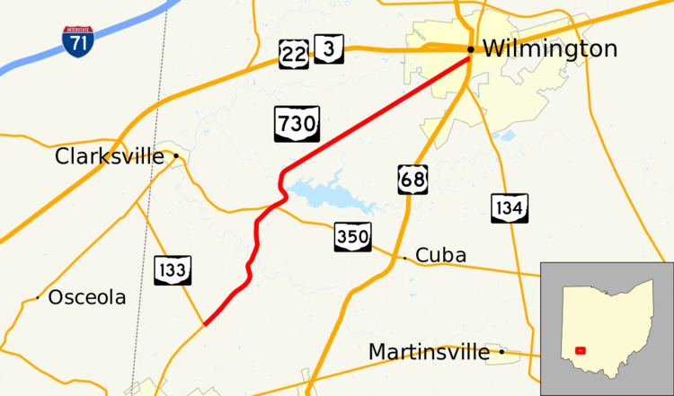 | ||
North end: US 68 / SR 134 in Wilmington | ||
State Route 730 (SR 730) is a 11.45-mile-long (18.43 km) north–south state highway in the southwestern quadrant of the U.S. state of Ohio. The highway travels from its southern terminus at a T-intersection with SR 133 about 2.50 miles (4.02 km) northeast of Blanchester to its northern terminus at a signalized intersection with US 68 and SR 134 in Wilmington.
Contents
Map of OH-730, Ohio, USA
Route description
All of SR 730 is situated in the western half of Clinton County. This highway is not included within the National Highway System (NHS). The NHS is a system of routes identified as being most important for the economy, mobility and defense of the country.
History
The SR 730 designation was applied in 1939. The highway has maintained the same routing between SR 133 near Blanchester and the US 68/SR 134 concurrency in Wilmington throughout its lifespan. When it was established, SR 730 was a gravel highway, excepting the northernmost 3 miles (4.8 km) of the route, which were hard-surfaced. Three years after its inception, the entire length of SR 730 was paved.
Major intersections
The entire route is in Clinton County.