
Existed: 1937 – present Counties: Darke Constructed 1937 | Length 26.94 km | |
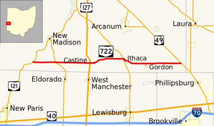 | ||
West end: SR 121 near New Madison | ||
State Route 722 (SR 722) is an east–west state highway in the western portion of the U.S. state of Ohio. The western terminus of SR 722 is at a T-intersection with SR 121 approximately 3.25 miles (5.23 km) southwest of New Madison. Its eastern terminus is at SR 49 nearly 3.75 miles (6.04 km) east of the village of Gordon.
Contents
Map of OH-722, Ohio, USA
Route description
SR 722 traverses the southern portion of Darke County for its entire length. No portion of this highway is included within the National Highway System, a network of routes determined to be most important for the economy, mobility and defense of the nation.
History
SR 722 was established in 1937. It was originally routed between US 127 in Castine and its present eastern terminus at SR 49 east of Gordon. Two years later, the highway was extended west to its current western terminus at SR 121 southwest of New Madison.
Major intersections
The entire route is in Darke County.